Long Charlie Spur(2024m) · Mt Aspiring National Park
There have been times when I have pointed out where water has got to during great rain events on tracks I have worked on. Sometimes the people who only visit great places like Mt Aspiring National Park when the sun is shining think you’re telling wild tells just to keep their attention. However, those who have seen a mighty Aotearoa Awa (river) in full flow plus will appreciate that there are times in the wild that you get to a river and think ‘I can’t cross that’…
By now it was late afternoon, and since I had my tent I decided to set up my camp on the same terrace that the hut is built on. After I did I quickly understood one of the reasons why the hut was built here. As I enjoyed my campside dinner I was rewarded for hiking through the rain. Slowly, stunning mountain after mountain appeared as the clouds parted and then finally disappeared. An absolute visual spectacle to witness as I started to dry out sitting by my campfire.
The scene was now set for an epic adventure, just where that adventure was going to be was up to the river levels in the Rees Valley the next day. At this point of my mish that was tomorrow's problem to solve, so I just focused on the magic bowl of miso in front of me. Not long after food the stars began to shine brighter and brighter in the clear skies above my camp. I began to think about retreating to the warmth of my sleeping back and having dreams of climbing mountains.
Early-ish the next day the first thing I heard when I woke was the hum of the Rees River. Even before I could see it I knew I couldn’t cross it. I decided to abandon another attempt at climbing Pikirakatahi Mt Earnslaw, and I would now have a go at climbing a peak directly behind my camp. My new plan was to head up to the first peak(2024m) on Long Charlie Spur.
The weather was the complete opposite from the day before, and there is nothing like a clear sky sunrise to get you pumped for climbing a mountain, even if it isn’t the one you originally planned to climb.
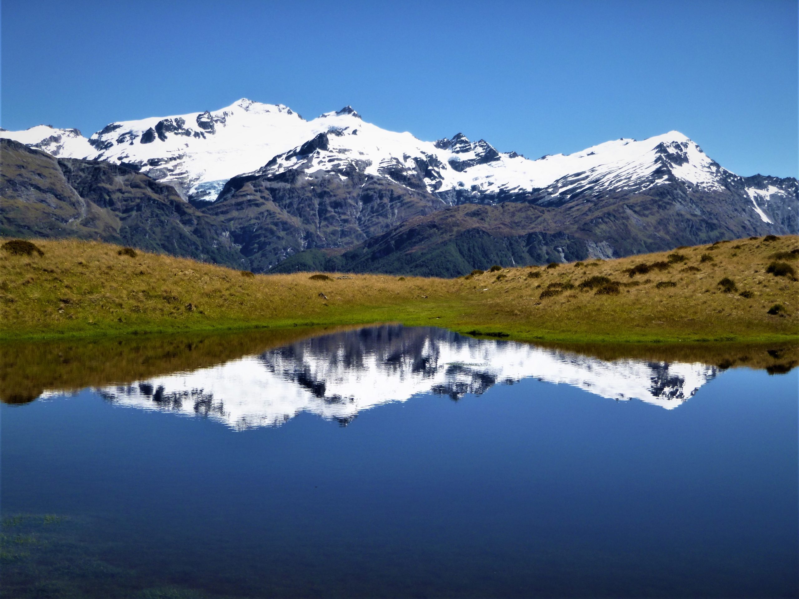
A slow and steady wander uphill took me up past a series of terraces, each containing a perfect mixture of small alpine tarns surrounded with alpine flowers. With each terrace the plant life eased, and near the start of the ridge to the summit I was on rock and only the hardiest of plants.
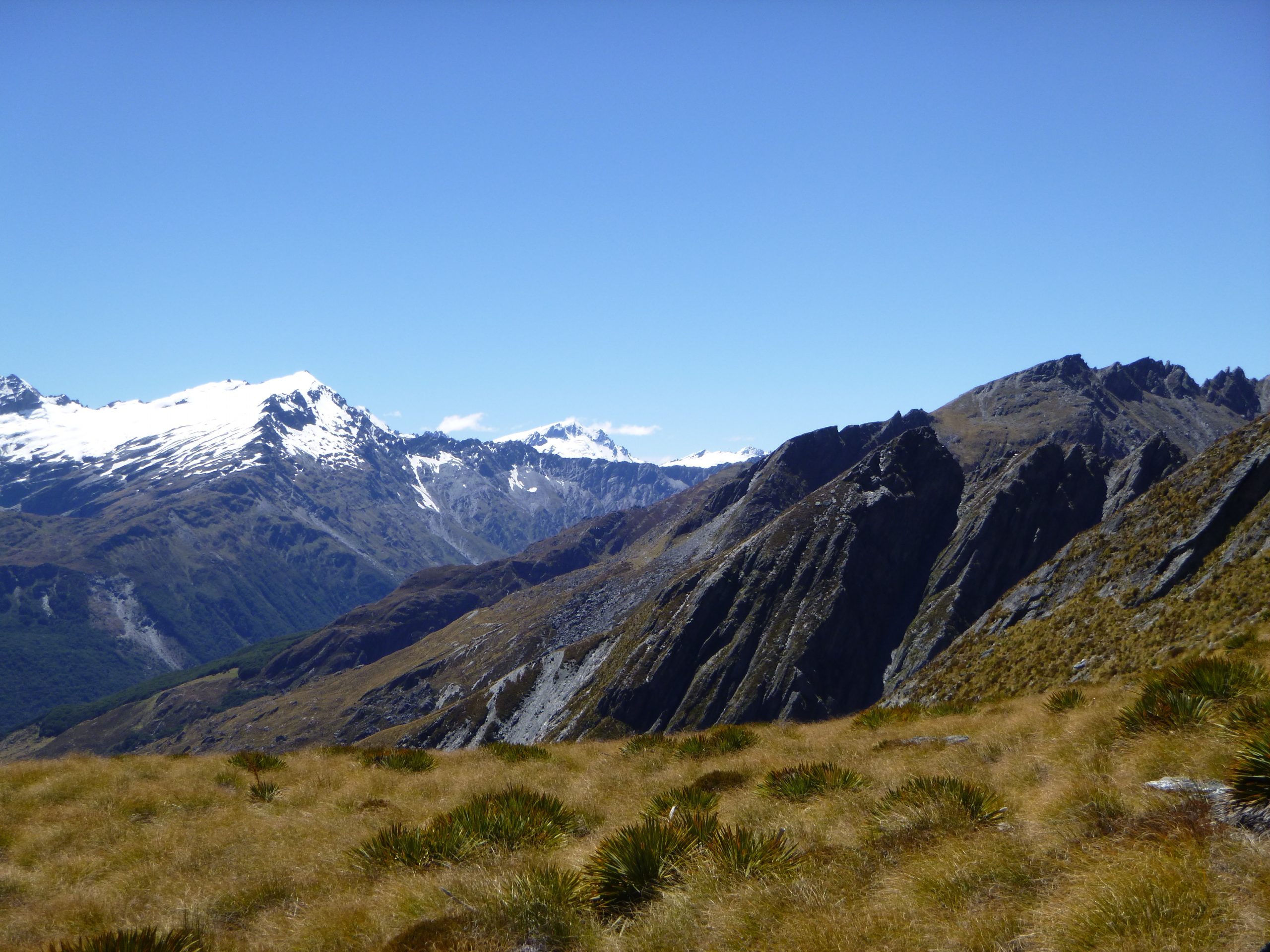
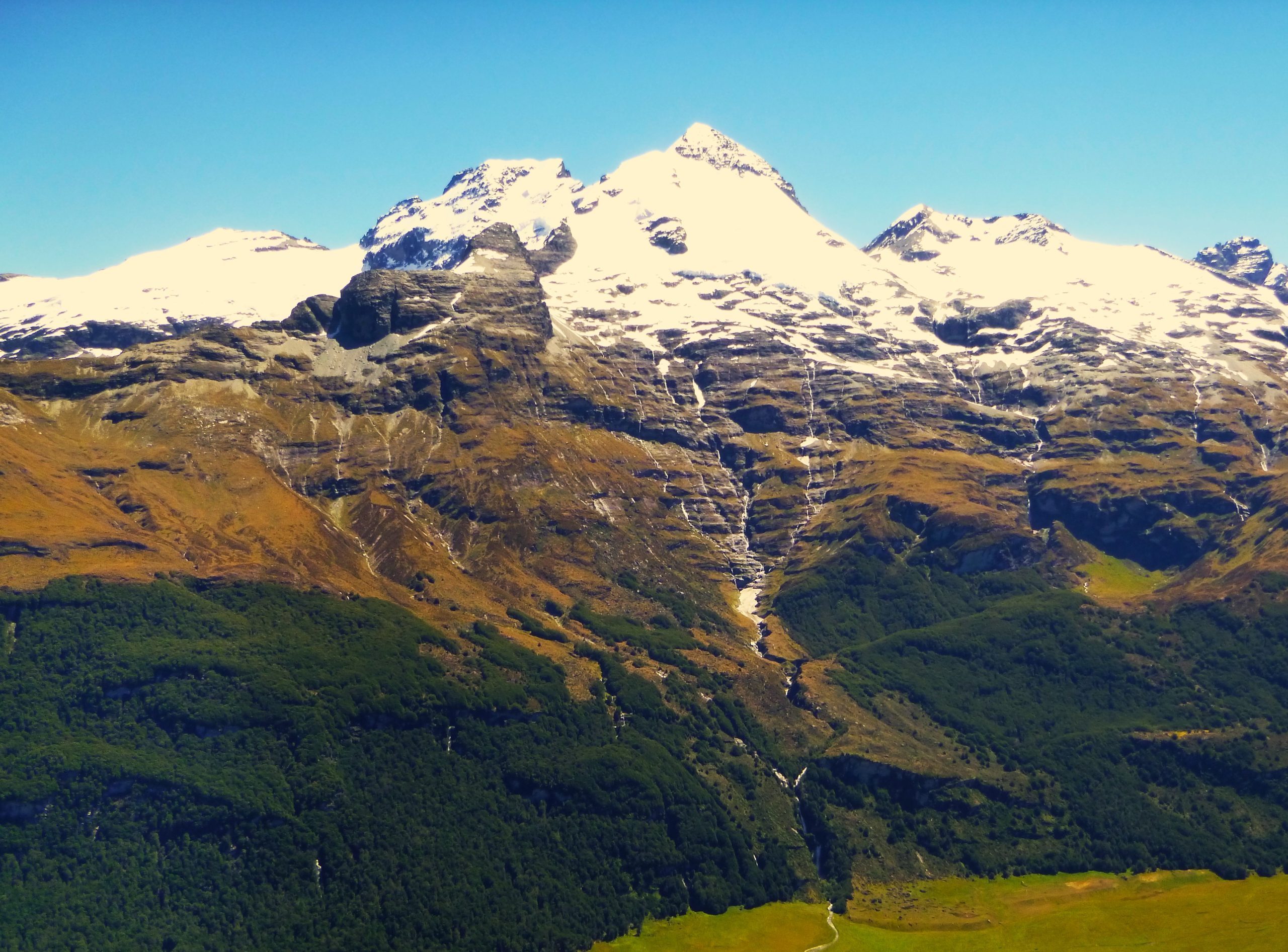
At one point I stopped for a drink and, as I rested, I looked across the Rees Valley at the east peak of Pikirakatahi / Mt Earnslaw and briefly wondered what it would have been like if the rivers weren’t running high. As I looked around at my plan B I wasn’t to bothered, my plan B was giving my some incredible views of the mountain I was supposed to be standing on…