Sunny Creek Basin · Fiordland National Park
As 2019 turned into 2020 I’m sure no one knew what life was going to throw at them during the year. Along with the rest of the world, my life was going to change, however unlike the rest of the world my living situation changed due to a large fridge door! I had know idea this was going to be my last big mish, but at least I went out after an epic…
After passing ‘Myrtle the Turtle’ 124 times as a guide on the Routeburn Track, I decided eight years later to venture into the basin above Sunny Creek. Many times I had dreamt of hiking above the track with the aim to climb one of the higher peaks in the Ailsa Mountains above the large alpine basin.
After leaving my home in Te Anau I drove up the Milford Road and was confronted with my first mission, finding a park at the Divide car park amongst the tangle of campervans, rental cars and the odd hiker wagon. I love the fact that of all the people here, very few will be spending a couple of days in the wild without other humans. I just had to get there first.
The track was busy until I passed Lake Howden Hut. Many were out enjoying the break in the weather as well as the stunning views that were on offer. The track is much less populated after leaving the hut and beginning the gradual climb up to Earland Falls.
There had been some heavy rain the day before I started my mish and Earland Falls was still cranking when I arrived. The waterfall in full flow is a sight to behold, however looking comes with the price of your dryness. I wanted to stay as dry as possible due to the fact that I wasn’t hiking to a hut or lodge, so I took the flood detour track to avoid a soaking at the hands of an angry waterfall.
After the falls the next task was picking a spot to take on the sub-alpine bush which needs to be climbed to gain the upper basin. After studying the map of the area many times I knew that the area of dense scrub and bush wasn’t very large, so I put my head down and pushed on.
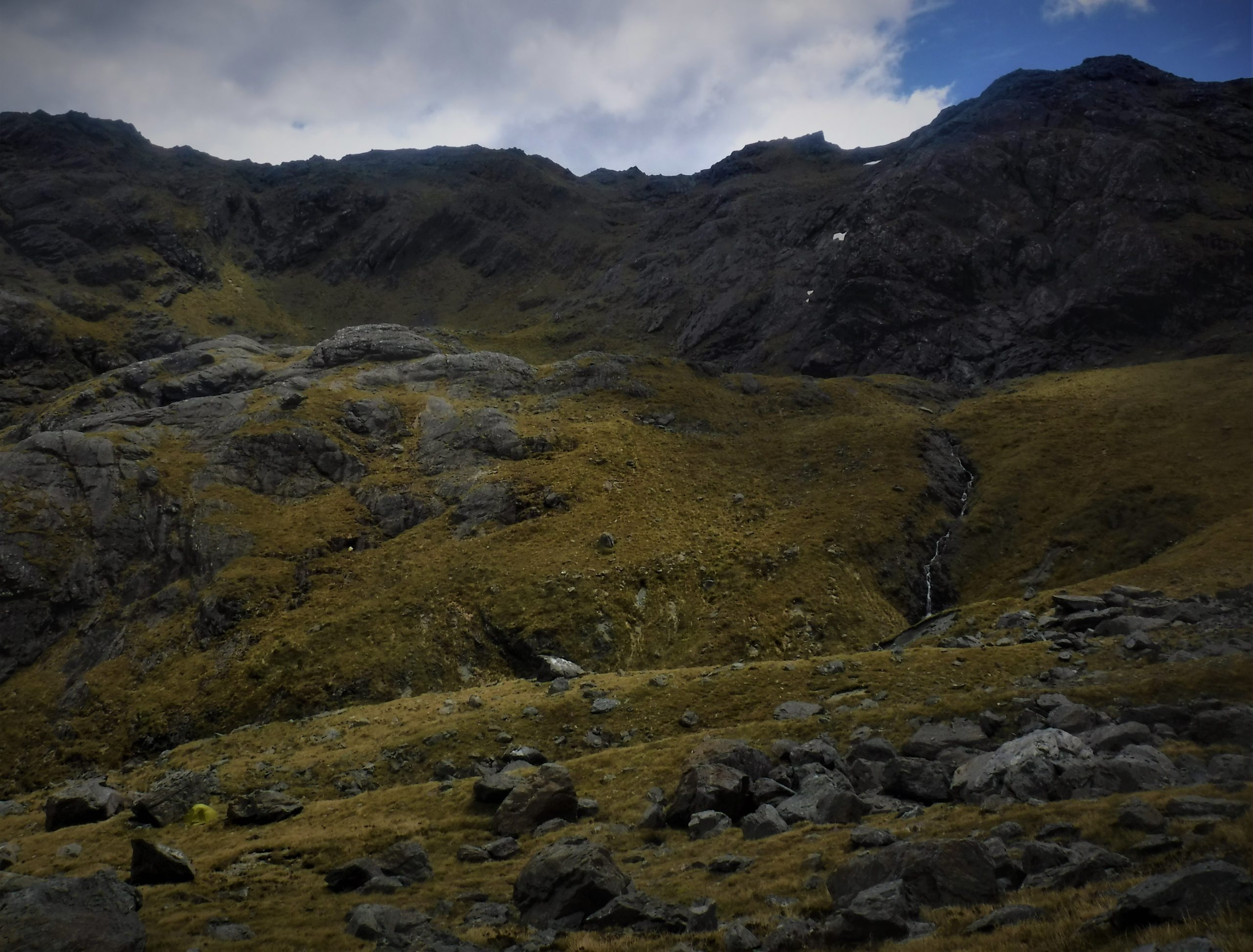
Our topo maps only give a rough idea of the terrain and above the scrub I got stuck in a boulder field that had many rocks of all shapes and sizes. Some pebbles, others bigger, much bigger. Negotiating rocks fridge sized to house-sized is a tough task with a full camping pack, but once above I instantly fell in love with the awesome upper basin that I was going to live in for the next couple of days.
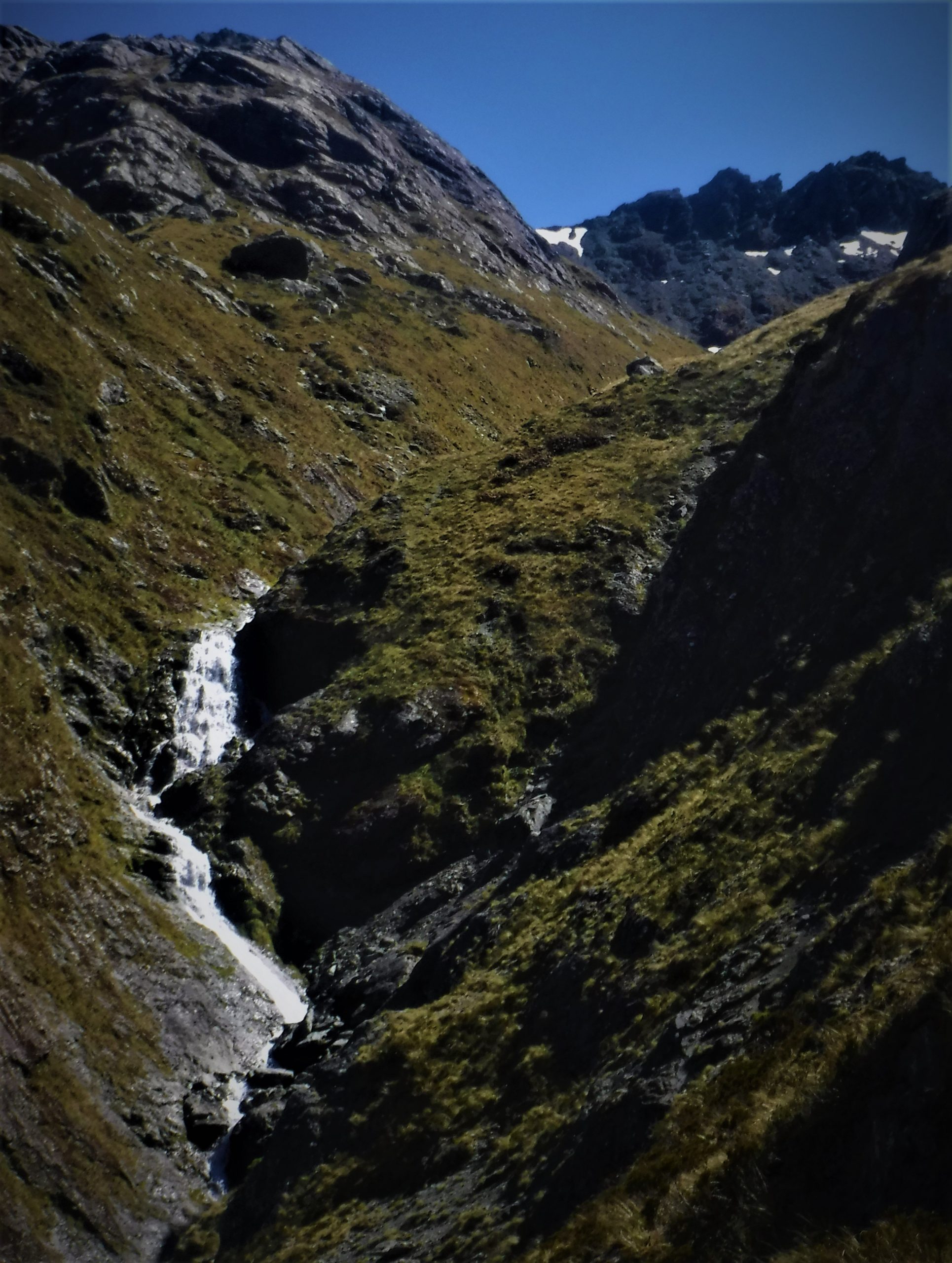
Above the boulders the hiking in the tussocks meadows is excellent, with views back towards the Darran Mountains increasing with each step.
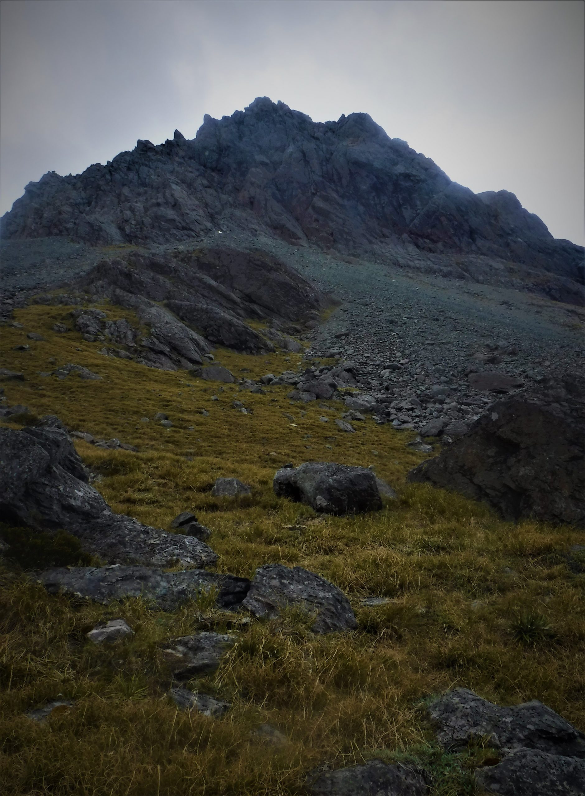
I had a short break and then decided I still had some fuel in the tank and was going to up the ante (plus the views) by continuing towards the highest point of the basin. I climbed to a flat spot between two huge rocks near the top and began to set up camp with the grin of success beginning to cement itself on my face.
I was very happy with the campsite and the view it had on offer. Mountains I had seen many times while guiding looked even better when viewed from a point much higher than the Routeburn Track.
With day one coming to a close I enjoyed an excellent meal while I stared in silence at the Earl and Darran Mountains. It might have taken a couple of years longer than I expected but now that I was here I knew it was worth the wait. The day was now over and I needed to get some rest before I tackled one of the many mountains that were standing tall all around me…