Whakaari Conservation Area
If at first you don’t succeed, try and try again. This mission was a classic case of one thing leading to another. Motivation is easy to obtain when living in a flat full of people who love hiking so much it is their day job. The tricky part is where do I go for a mission on my days off with so many options available? I had seen some epic pictures of Lake Luna and its huts and track in an old hiking book, and without a second thought I was driving alongside Lake Wakatipu on the Glenorchy Road...
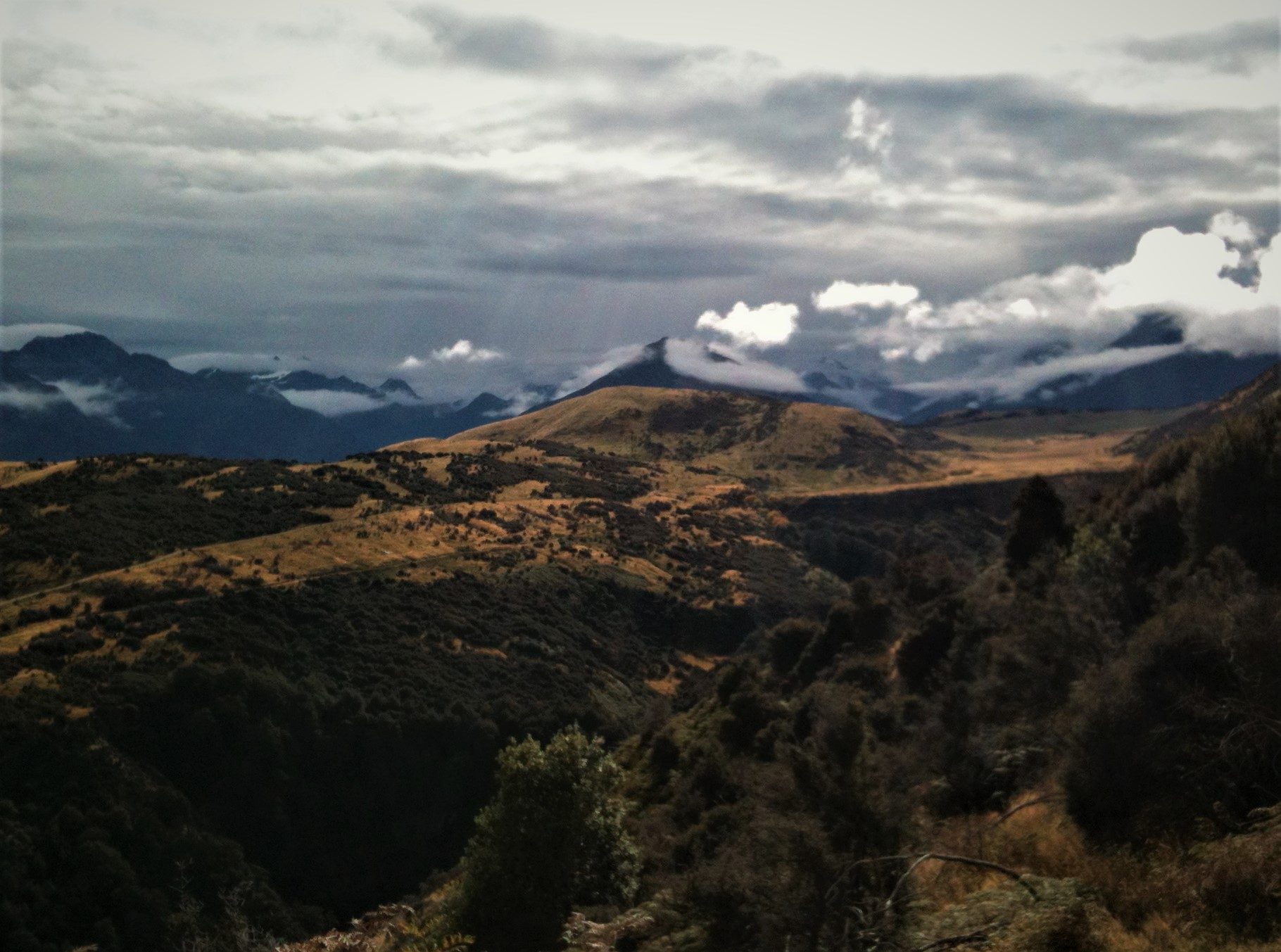
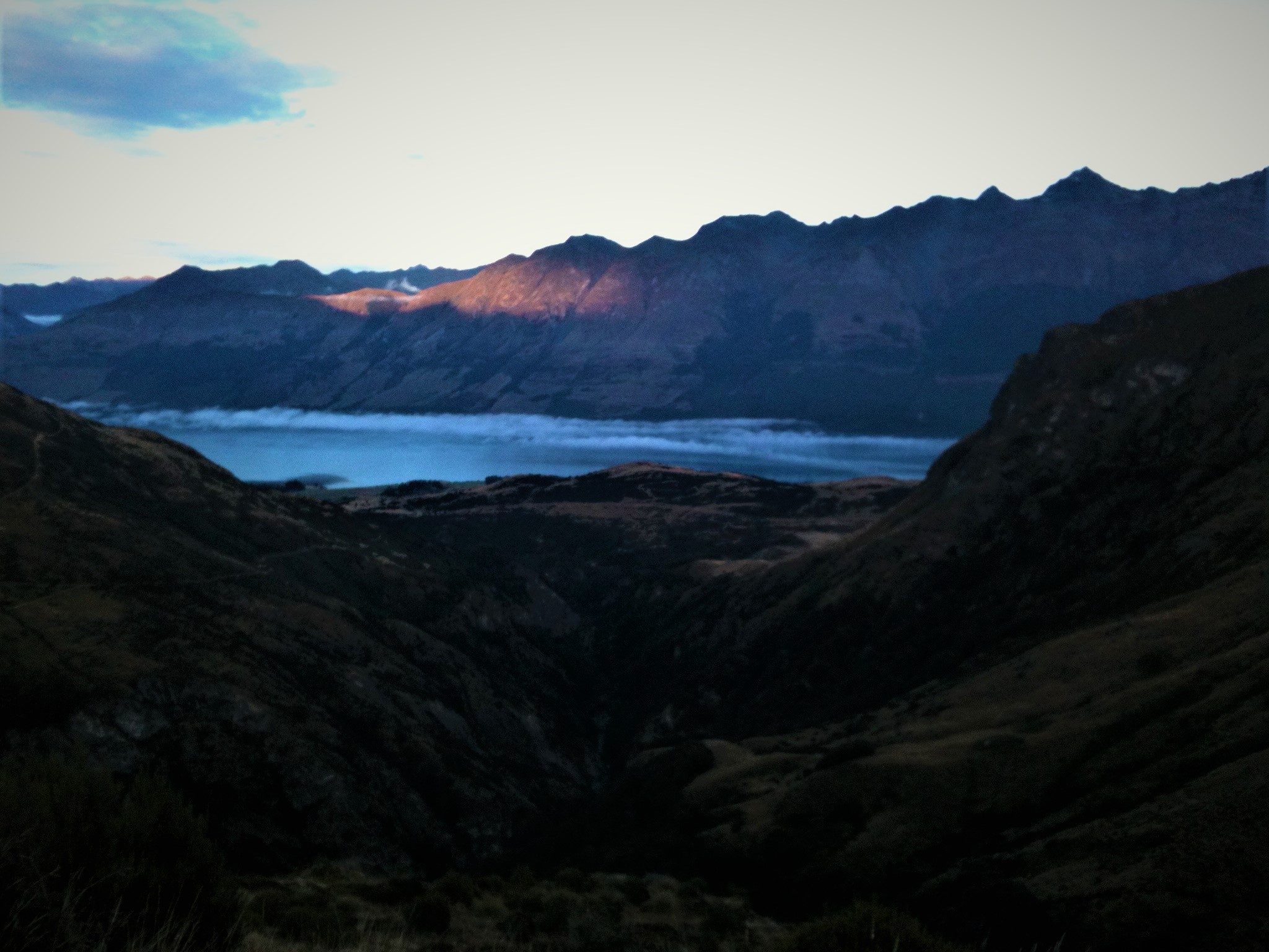
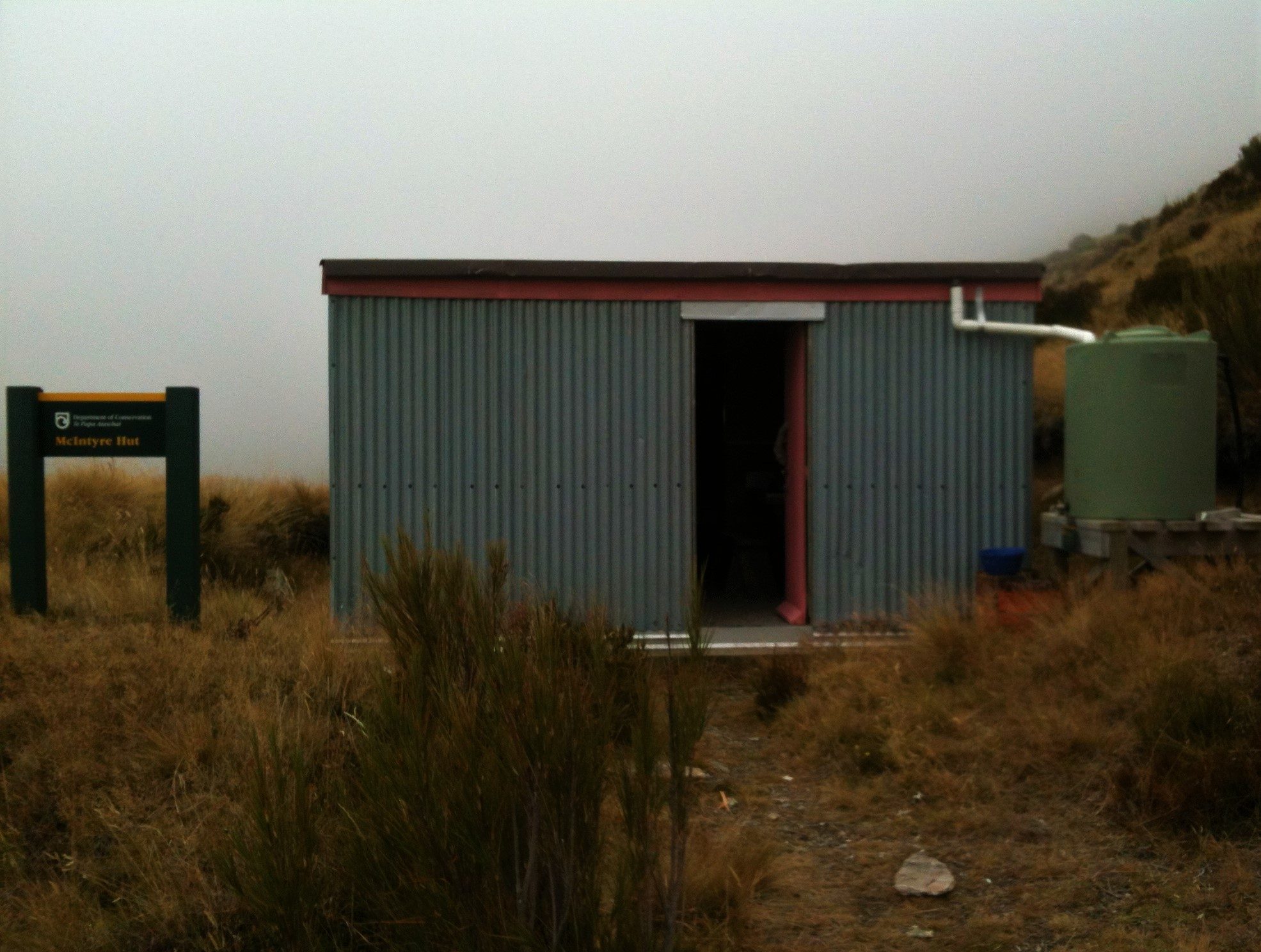
Any excuse to take in the stunning scenery of the Glenorchy Road, and knowing rain was forecast for the next day I took my time, and enjoyed the short drive to Twenty Four Mile Creek. I was excited to get into the mountains, and while I was getting ready I saw a signposted gate which stopped me in my tracks, literally. The sign informed me that there was no longer public access to Lake Luna via the Reidys Spur Track, and it seemed like my mission had finished before it started. I was ready to hike, so I continued north towards Glenorchy looking for a plan B. It is lucky to be in an area with so many different hikes to choose from, plan B wasn’t difficult to find! I saw the familiar green and yellow colours of a DOC Sign in a car park about 1km out of Glenorchy, so I turned in for a look. This was the first of many missions around Whakaari Conservation Area, and it is funny to think it all started with an abandoned trip to another place. I studied the map, and decided to head for McIntyre’s Hut, located on the west face of Mt McIntosh(1701m). The bulldozed road around the base of Mt Judah(1416m) is an easy way to warm up, and as I walked up the road I could see my mission objective on the other side of the Buckler Burn Valley. To cross over the Buckler Burn the track drops down a couple hundred meters, and then bulldozed zigzags make their way up to the little tin hut. The effort, skill and guts shown by the fellas who mined this area is incredible. The place is as far from flat as possible, and yet over time a small settlement has been carved into the scheelite rich mountainsides. Now a long time since the mining days, some of the buildings of that era make for excellent hiking huts. The view from McIntyre’s Hut is awesome, looking down to the lower reaches of the Te Awa Whakatipu / Dart River and Lake Wakatipu, and across to Mt Bonpland(2343m) and the rest of the Humboldt Mountain Range. As the evening rolled on, I watched the dust of the Dart Riverbed beginning to be whipped up by the strong winds of an approaching nor’west storm. The evil dark clouds swallowed the light before I could witness any sort of a sunset, and by evening I was looking at a completely different environment. McIntyre’s Hut is reasonably sheltered from the wind, and was a great little place to drift off to sleep in as the rain began to tap the tin roof like a snare drum.
An early-ish start the next morning revealed a grey drizzly day, and the reality of a hike back to my car in the rain. A couple of encouraging coffees got me warmed up and going, and it wasn’t long before I was back down at the Buckler Burn crossing, then back up on the Judah Track. The journey was successful, even if it wasn’t the original plan, and with that little taste I knew I would be back to visit Whakaari Conservation Area in the future again and again…