Potts Range Peak(1948m) · Hakatere Conservation Area
To many the thought of clambering up a snowy mountainside seems like a strange pastime. Struggling against gravity in order to simply stand on top, then immediately climb back down again can sound a little bit pointless. Another thing that may sound a little weird is someone returning to the same area time and time again to repeat the torture / challenge. However, once you get the taste of satisfaction only available after putting in the effort you may find yourself becoming a wilderness addict just like me!
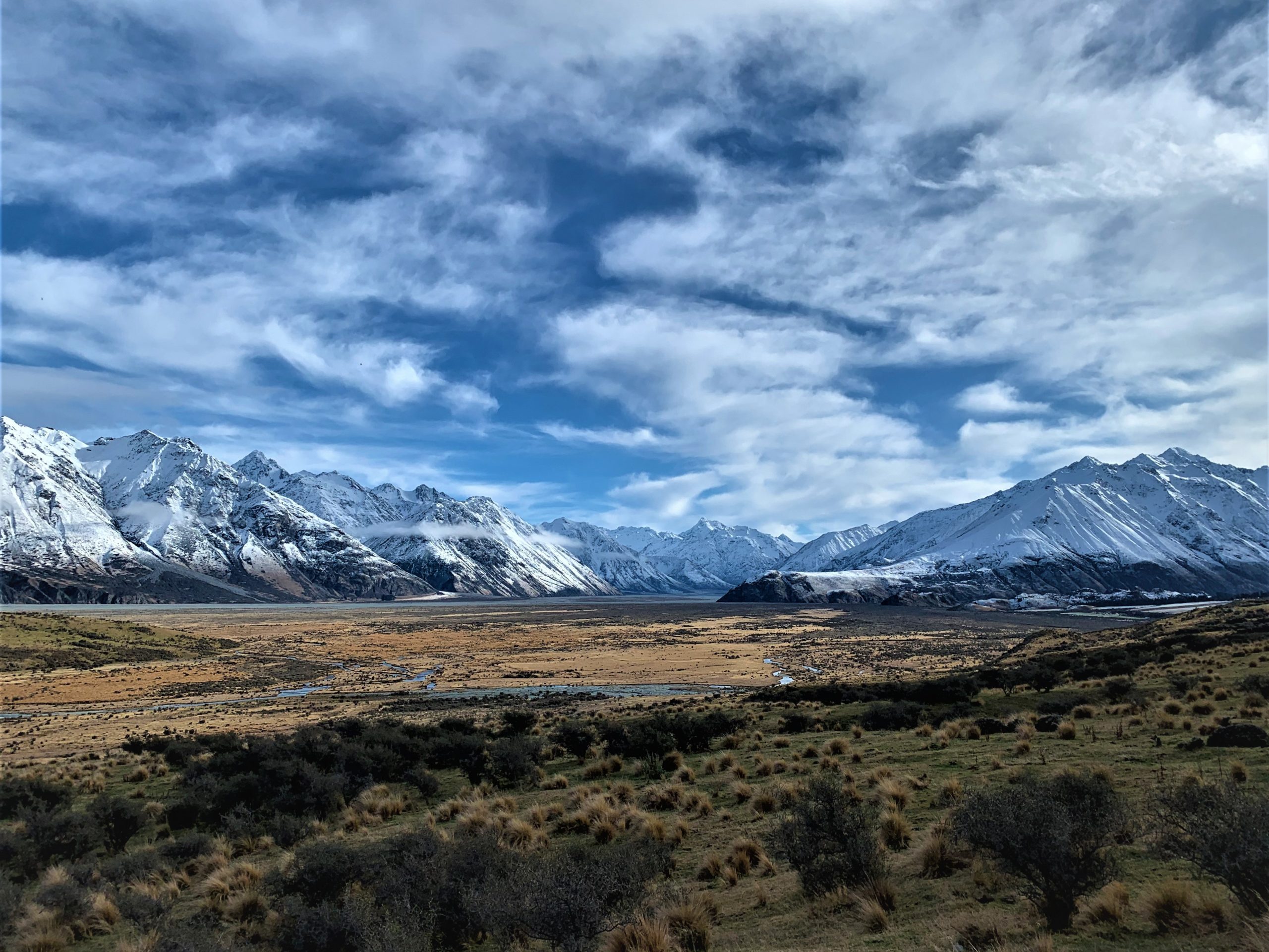
With my pack on I looked up at my early morning warm up, the track into the Erewhon Mountains. The ‘weather’ that had recently passed through the area had left an unexpected coating of snow, which just added to the dramatic feel of the grand location. I followed the snow-covered bulldozed track that zigzags its way up towards the entrance to the hanging valley and the impressive cirque of big peaks at the top of the valley. Of all the mountains Mt Potts(2184m) stands tallest in its permanent placement on the east side of the small and yet somehow huge valley.
On this trip my goal was to climb the ridge on the west side of the valley to the first big peak, marked as Point 1948m on the NZ Topo Map. Instead of continuing into the valley towards the old skiing area I put my crampons on and climbed up to the ridge (climbers left) at the entrance to the valley.
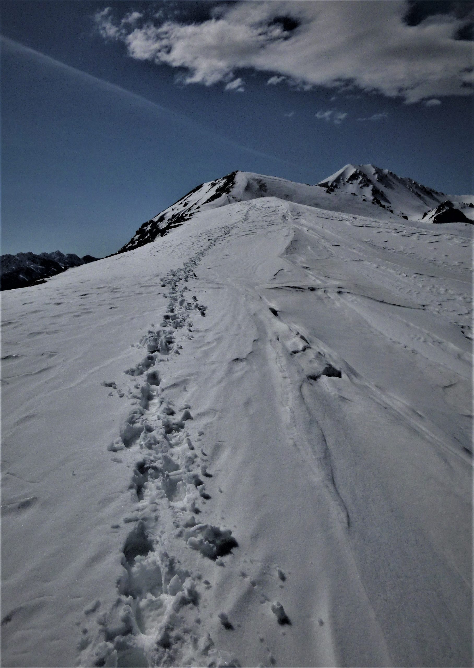
Winter was still in full swing in the Erewhon Mountains, and I went straight from the track into the fluffy deep powder snow from the night before. The first part of the climb up the ridge was a repeat of two steps forward, one step back. The fresh dusting made forward progress a struggle in places as the fluffy fresh snow would build up in my crampons, and then I would slide backwards slightly with each step until I bashed it out. The higher I got the easier it got and once onto the upper part of the ridge the snow was harder, and this meant my crampon spikes could bite into the ice making forward travel much, much easier.
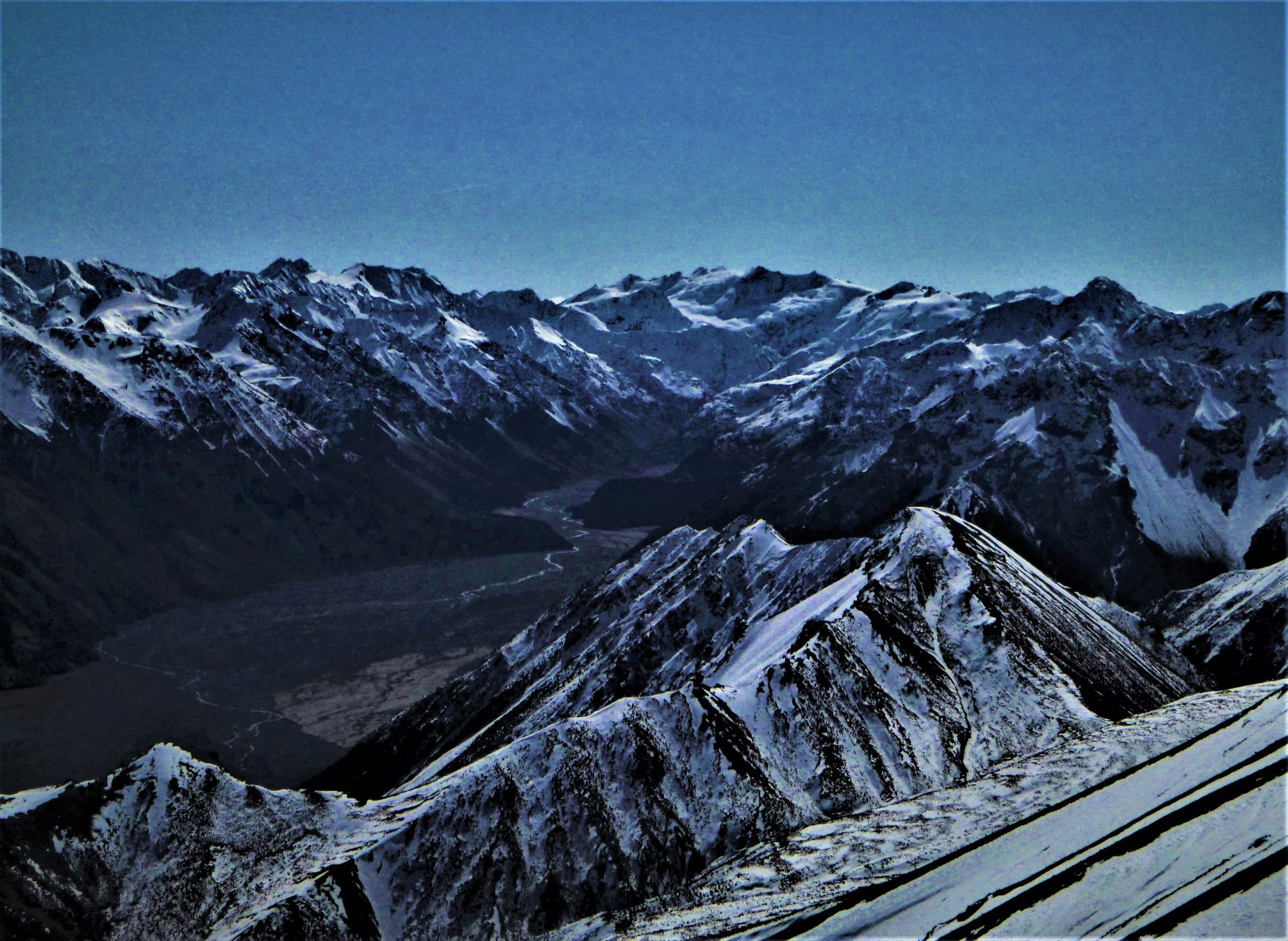
As I inched closer to the summit cone of Peak 1948m the views reminded me why I was doing this, and acted as motivation to keep me going. The last part of the climb was a steep scramble on ice-hard snow, through ice-glazed rocks to the summit. After a couple of calf screaming moments, I got onto the small flat dome that is the top of the mountain. From the summit the views were awesome, with snow capped peak after peak in all directions.
To the south was the cluster of New Zealand’s tallest mountains and standing tallest on the southern mountain skyline was the unmistakable legend that is Aoraki / Mt Cook(3724m). After taking in the view and being grateful for the outstanding weather, I started my descent. My original plan was to traverse further north to Peak 2140m, then drop down to the old ski field tracks. Looking down into the valley I could see that a recent avalanche had rolled off a face I would have had to traverse to get down to the ski field track. It was an easy decision to abandon my plan of travelling further along the ridge as I wanted to stay as far away as possible from the dangers of 'death from above'. After turning back I plugged my way back down the steps I had made earlier in the day, and before I knew it I was warming my semi-frozen toes and enjoying a brew in front of the fire at the crib in Lake Clearwater Village. Another mish, another peak climbed.
If you haven’t been to the area then I suggest you make the pilgrimage, but I do warn you that it just might make you into another wilderness addict…