Te Ahu Patiki/Mt Herbert(919m) · Bank Peninsula Area
Standing at nearly 1km above the Pacific Ocean on the South Island's east coast, Te Ahu Patiki/Mt Herbert stands tallest over the many beautiful bays and coves of Banks Peninsula, but was once a much bigger mountain. Whether it be taking in the sights from anywhere on the easily accessed and spectacular Crater Rim Track on the Port Hills, or exploring the network of tracks that make their way through the many coastal mountains of Banks Peninsula, there is so much to see on the remains of this once mighty volcano...
Banks Peninsula was a large volcano similar to Taranaki/Mt Egmont(2518m), which began to violently destroy itself around 10 million years ago with a series of volcanic eruptions. What remains today makes for awesome undulating hill hiking, with unique views of the Pacific Ocean, Canterbury Plains, and the distant mountains of the Kaikoura Ranges and Ka Tiritiri o Moana/Southern Alps. The best way to experience Banks Peninsula is to climb Te Ahu Patiki/Mt Herbert(919m), and the mountain can be accessed from nearly every direction.
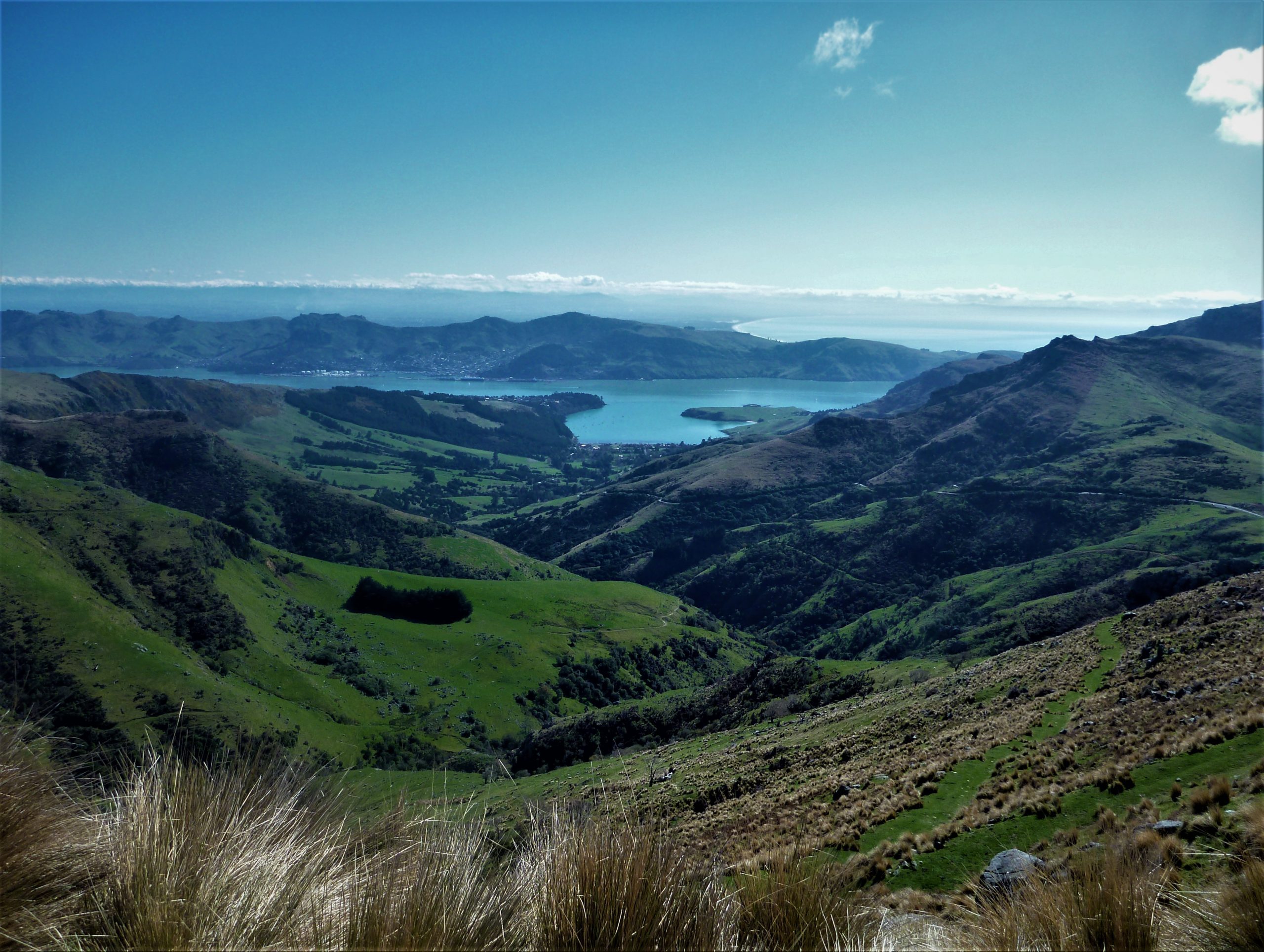
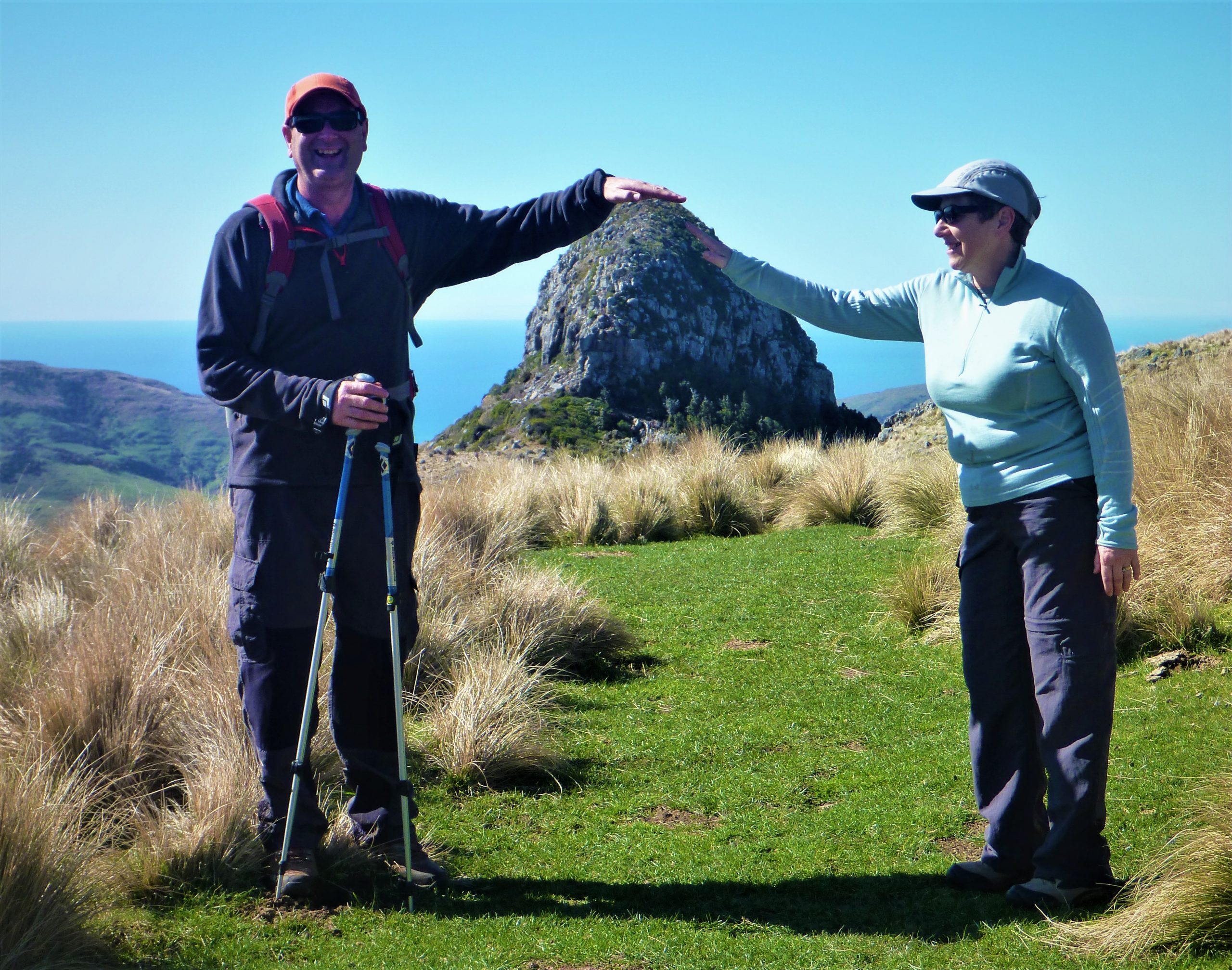
For this adventure an early-ish start from Christchurch had my parents and I heading to Purau Bay, then up past the rocks of Lions Head to the Monument car park near Port Levy Saddle. The Monument(711m) is an impressive cone or ‘Volcanic Plug’ which pokes out of Banks Peninsula like a giant upside-down ice cream cone. Driving up to the Monument car park definitely takes out most of the UP when hiking Mt Herbert, and the drive there always has outstanding views as you make your way through the many bays on the way to the start of the track.
The track up to Mt Herbert passes under the west face of the Monument(711m), and the low angle makes the mini peak look even more impressive. The day was warm with very little wind, and when we got to the Te Ara Pataka Track junction, we soaked up the sunshine and the epic elevated view down to Purau Bay, now over 800 meters below us. From the junction the track steepens for the last two kilometers of the hike up Mt Herbert, and also climbs over Te Ahu Patiki/Mt Herbert’s Low Peak(913m) on the way to the true summit.
We were extremely lucky with our weather, and the clear skies meant 360 degree views from the top. We could see the brown waters of Te Waihora/Lake Ellesmere, and the sweeping expanse of the Canterbury Bight in the Pacific Ocean to the south. To the west, across the many dairy farms of the Canterbury Plains, stood the snow-capped mountains of the Southern Alps, and to the north the large peaks of the Inland and Seaward Kaikoura Ranges.
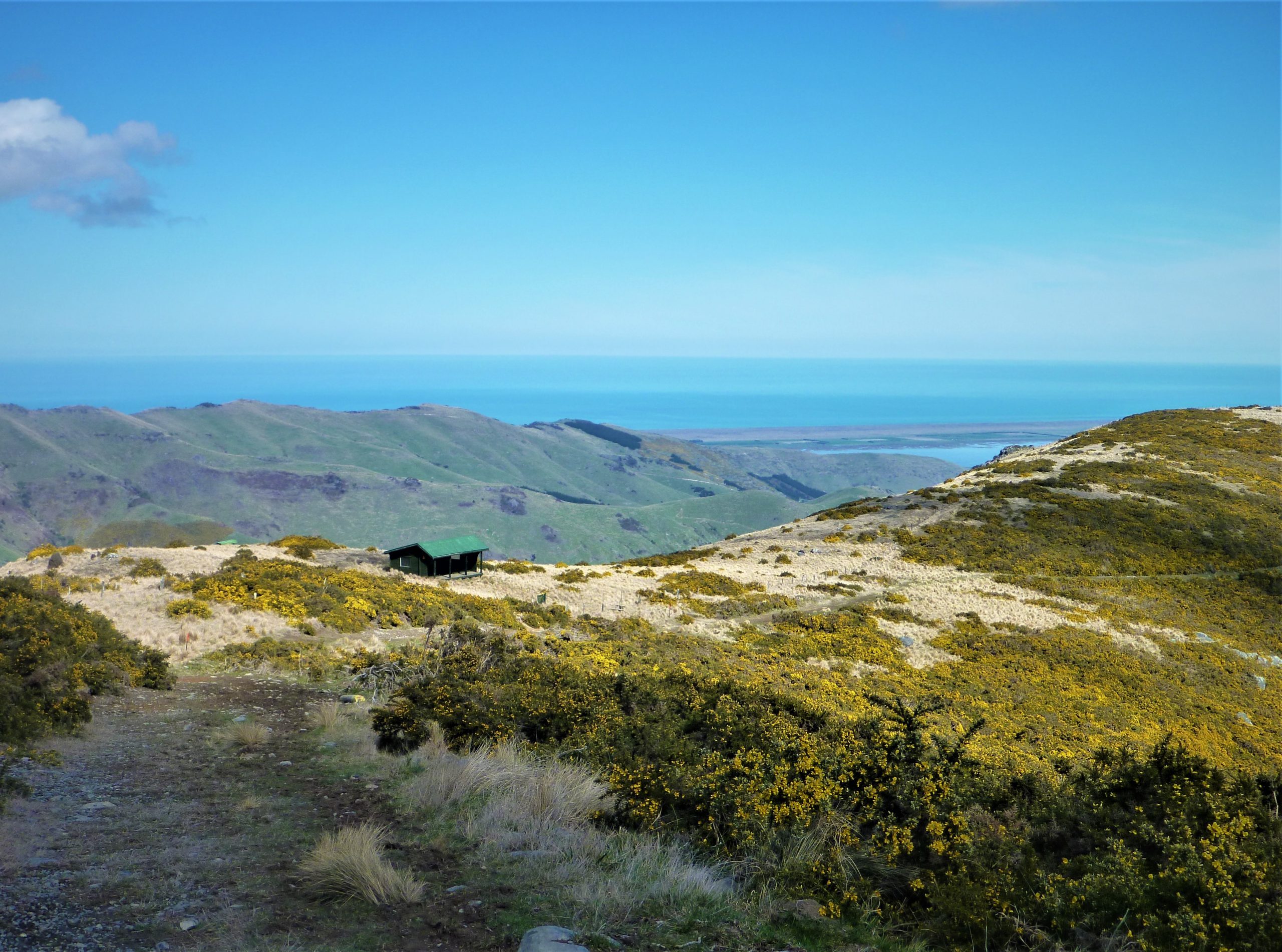
We dropped down the south side of the mountain to the Mt Herbert Shelter for lunch, and had an uninterrupted view down the Te Wharau Valley to Te Wharau/Charteris Bay. After an epic sandwich, no doubt enhanced by the incredible surroundings of what was once a mighty volcano, we headed back up and over Te Ahu Patiki/Mt Herbert(919m), then back down towards the Monument Track. Hiking the track in reverse gave us great views of the unique volcanic spire that is the Monument(711m), and the weather blessed us with a cooling breeze as we got closer to the car park.
The last job of the journey was the drive back home, and once again the small bays that must be negotiated to return to Christchurch occupied the windscreen like an ever-changing scenic painting, made even more stunning by the evolving colours of the late afternoon sun. Our mish up what was once a mighty volcano was a magical way to spend a day in Banks Peninsula!