De Lambert Falls(59m) · Fiordland National Park
With no knowledge of the history of Piopiotahi / Milford Sound it is easy to kick back and relax in a car or bus when driving along the epic road and not think much about the first exploration of the route the road now takes. A true visionary of a good Fiordland Mish is the legendary explorer / teacher / expedition leader, and possibly bulletproof, William Grave of Oamaru. After most of Fiordland had been mapped he stepped (literally) up to the challenge of filling in the still blank spaces on the map…
Even before starting his exploration he would bicycle to Te Anau and beyond, a huge mission in itself. One of his most legendary missions was the first overland trip to Sutherland Sound. The “hike” of around 30km took weeks, and then needed to be travelled in reverse to get back to civilization.
William ‘Bill’ Grave is a person who has taught me that tough times are still enjoyable when reminiscing about them after the mission is finished. A good point as, on one of his trips of exploration, his team put up with 17 out of 18 days of rain!
In 1909, along with fellow Fiordland hardened route prospector, Arthur Talbot, he discovered a route up and over the Homer Saddle over Snowball (Mt McPherson) into the Esperance Valley and onto Milford Sound.
A truly epic adventure in some of the world’s deepest and steepest valleys. This created a third option to get to Milford Sound, and also a much sought after direct route from Lake Wakatipu.
Starting with easy hiking via the Greenstone or Routeburn Valleys to access the Hollyford Valley, the real adventure kicks in when climbing over to Milford via the high alpine route, the Grave-Talbot Pass(1697m) located in the staggeringly steep mighty Darran Mountains.
After establishing the route, the two talented and visionary explorers returned each summer to improve the ‘track’ over the pass into the Esperance Valley.
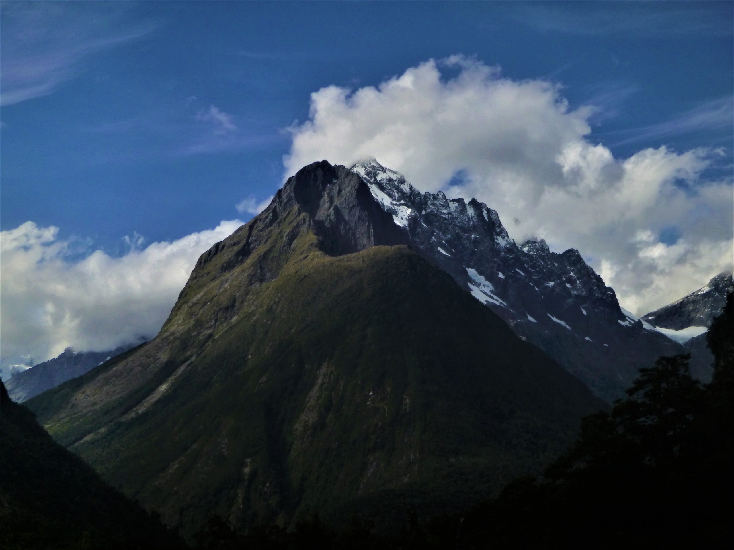
I discovered when climbing Mt McPherson(1931m) via Talbots Ladder that the route is very exposed, with huge drops into the Upper Hollyford Valley and an even bigger drop to the west into the Cleddau Valley.
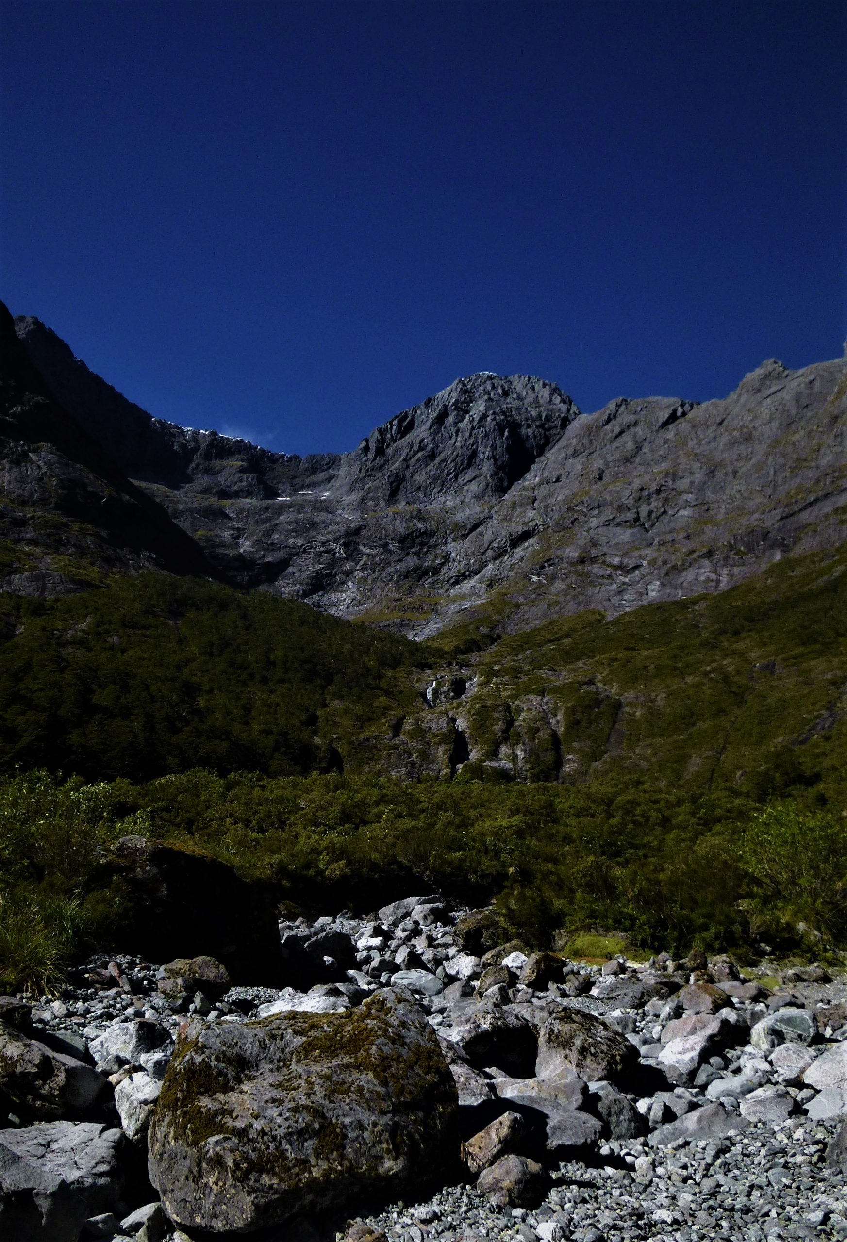
On this mish I wanted to check out the west side of the route after seeing the Esperance Valley from the summit of Mt McPherson(1931m). Because the valley floor is 1100 metres below the mountain’s ice-covered summit I wanted to reverse the view and put my boots where I was looking.
After a study of the map of Fiordland (one of my favourite ways to fill in time), I saw good camping potential at the base of De Lambert Falls(59m). This was once the location of one of the huts on the route. This place would have been an incredible spot for a mountain shelter but unfortunately it was removed by an avalanche many years ago. This has been a regular occurrence for huts built in the Darran Mountains and over time most have been forcefully removed from their foundations. Knowing this makes the place so much more rugged and remote, plus very appealing for a mish!
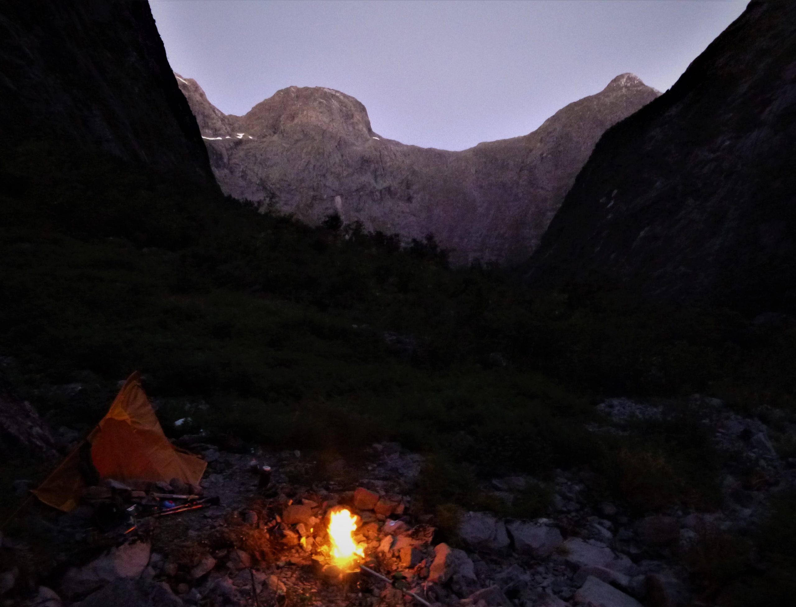
I had to drive all the way from Queenstown to get to the start of the track, and this meant I arrived at the car park near the Donne River Bridge in the afternoon. I didn’t fancy my chances of getting all the way to the Falls on the first day, so after making my way along the true left of the Donne River to the entrance of the Esperance Valley I set up camp. The light was fading as I sorted gear and set up my tent. Until this point my day had been rush, rush, rush. But now I finally had the time to survey my surroundings and it is safe to say my eyes were very happy. From my camp I was looking out of the valley at the very visually pleasing peaks Mt Underwood(2222m) and Mt Patuki(2246m). It would seem my feet are slipping perfectly into the footsteps of William Grave...