Tarawera Mt Sinclair(841m) · Banks Peninsula
The adventures of Captain James Cook prove that, once you get adventure in your blood, the mish never ends. Cook and his crew sailed the high seas with no maps or charts, and to discover what he discovered way back in the 1700’s boggles the mind. An important member of Cook’s Crew was the botanist and naturalist Joesph Banks. Cook took care of the crew and ship, and Banks sorted out the science and animal and plant life. Due to his high ranking in the crew Banks had a whole peninsula named after him, and I wonder how he’d feel if he knew that the hills within his peninsula would provide fitness and entertainment for all, long after his visit back in 1770…
At first Banks Peninsula was named Banks Island, as Captain Cook didn’t realize that the land was connected to what would become the Port Hills and Christchurch City. The Endeavour never touched down on the island, which is actually a peninsula, so Banks never got a chance to see the place on foot. This minor mistake was one of only a few on Cook’s first map of Aotearoa, and when you consider when he was out exploring, with zero technology to use, then his map is actually very accurate. I have always wondered what New Zealand would have looked like as the Endeavour made its preliminary voyage.
Along with the tracks which are dotted all over the Port Hills, there are many kilometres of trails up, over and around Banks Peninsula. Some lead to huts, others to some of the summits within the peninsula. Tarawera Mt Sinclair is the third highest peak in the peninsula, and can be accessed from multiple points via well-marked hiking trails.
On this mish I approached the mountain from the southeast on the Te Ara Pateka Walkway which makes its way over the tops from the aptly named Hilltop to Te Ahu Patiki Mt Herbert, the highest point on Banks Peninsula.
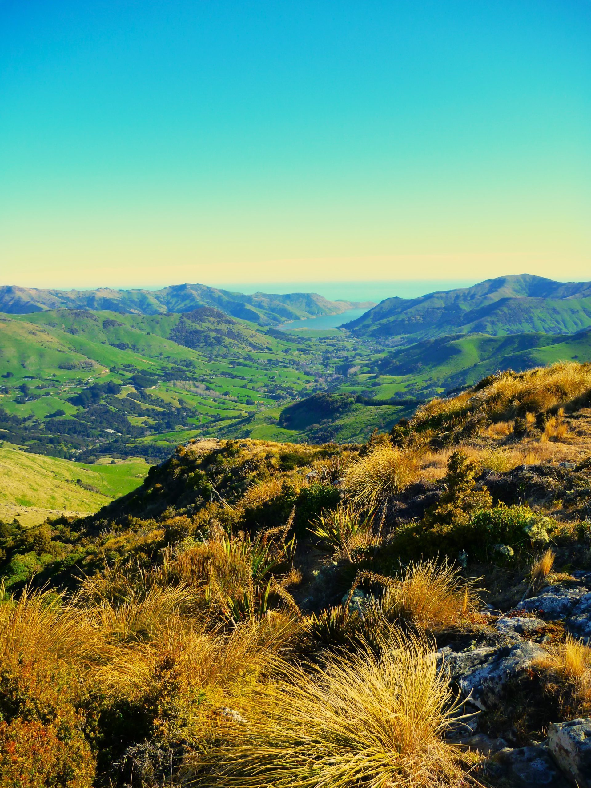
Apart from the odd wind gust, I had excellent hiking conditions for my adventure. My hike took me through Montgomery Park Reserve and then out into the open near Whatarangi Totara Reserve. The tops are lined with the stumps of former great Totara Trees like it is a cemetery, with each stump a headstone of a great tree of the past. The Peninsula looks a lot different from when it was first discovered many years ago!
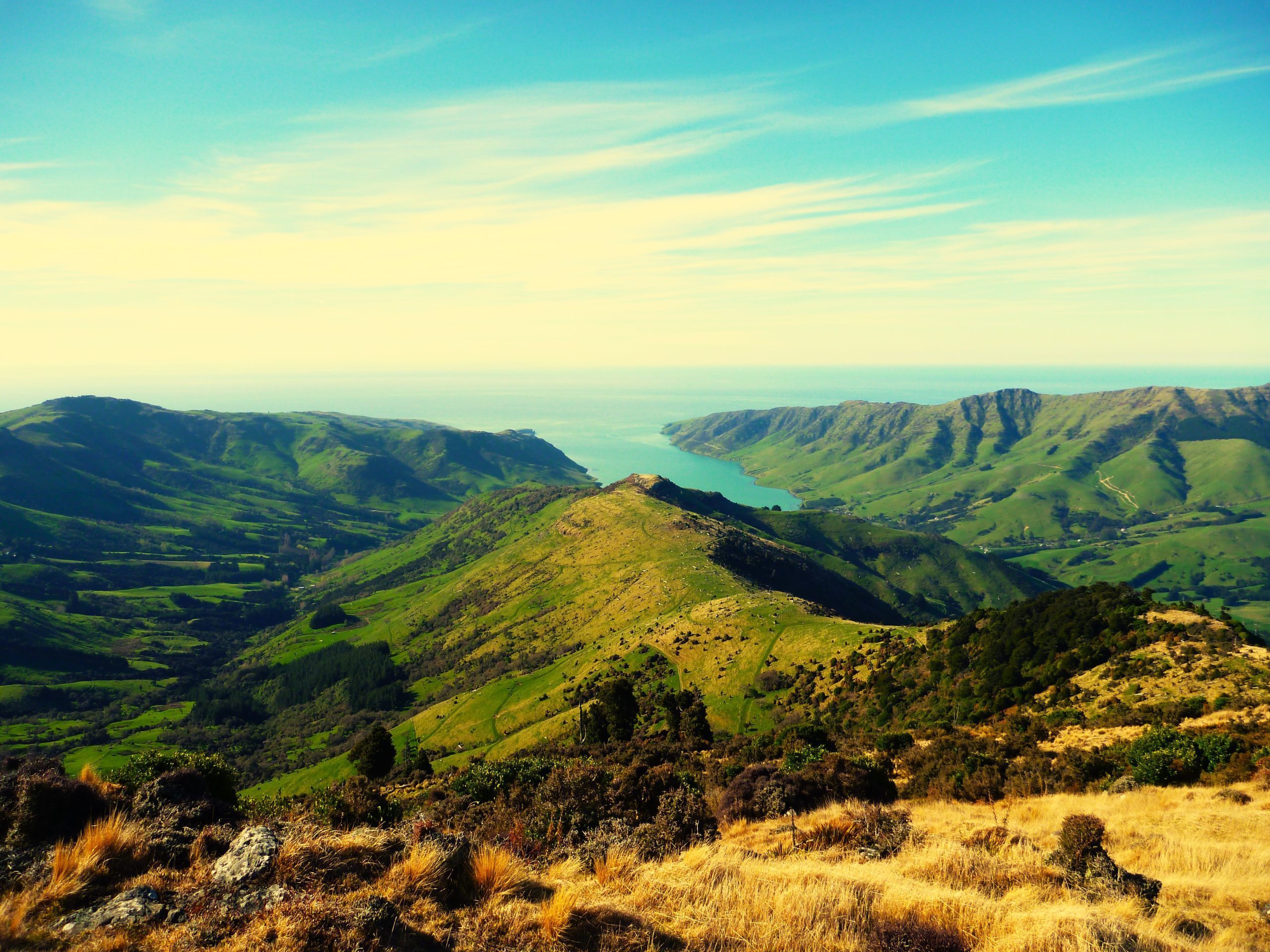
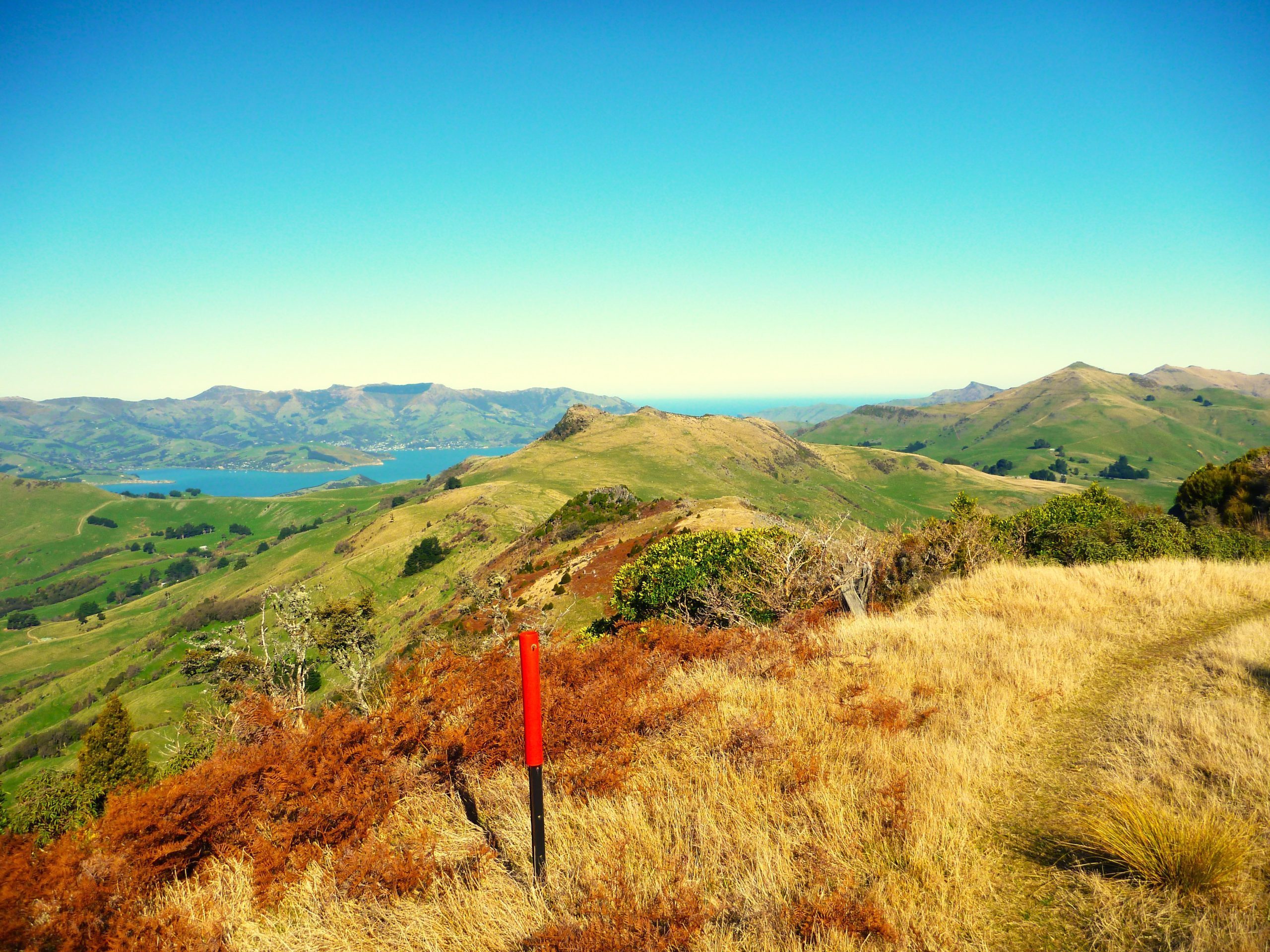
While walking out in the open I had excellent views of Pigeon Bay and Koukourarata Port Levy, and beyond to the deep blue of the vast Pacific Ocean. One final push took me to the summit, and I had picked a great day to be there. Beyond the Mt Sinclair summit the track kept going till I could see it reaching the top of Te Ahu Pateka Mt Herbert, I was tempted to continue on, however time restraints meant I had to turn back.
The stroll back along the track was just as good, with views of the much less populated east side of the Peninsula. Signs of mankind on the rolling hills petered out the further east I looked, and although the place is close to Christchurch City it seems so far away when looking at it on foot on the Te Ara Pateka Walkway.
I made my way back past the Totara graveyard and then re-entered the bush at Montgomery Park Reserve. My hike was over, but I knew I would be back again, as the sights from the track are definitely worth a second, third etc look. If you find yourself in Christchurch with a spare day (and a vehicle) I recommend a drive out amongst the hills of Banks Peninsula and then a hike up to where the views are near endless (on a cloudless day). Historic, beautiful, and just enough of a challenge to let your legs know they have been used in the right way. The is a vault full of trekking treasures to be found in Banks Peninsula, I’m not sure if Captain Cook knew it at the time but I’m sure that Joesph Banks’ brilliant Island / Peninsula is an outstanding place to put your own two feet - unlike the person the place was named after!