Hakatere Conservation Park
Over time I have clocked up many hours under the stars during the times I have foregone a tent and opted for a night out in the open air in my waterproof bivvy bag. While working on the Routeburn Track I spent the odd night outdoors along with my fellow guides starring up at the endless stars that dot the sky, before waking up a few hours later wrapped in a damp duvet. Camping without a tent can take you back to the days of the early explorers, who tackled the harsh New Zealand mountain environment with only a swag and a lot of determination…
A fateful mish into Hakatere Conservation Park was my first experience of not getting to my planned destination and being a forced bivvy without a tent. I was very unfamiliar with the Hakatere area west of Lake Heron, so after spending a lot of time around the Taylor Range I was keen to explore more of the park. I saw Boundary Hut located amongst the mountains of the Potts Range and felt the need to visit the area for a night's stay at the hut. I had a topo map which showed the hut, but it was located right on the edge of the map, and this would come back to haunt me later when I walked my way off the map I was carrying.
I drove into the 60,000-acre conservation park near Mt Somers Village on roads which went from sealed to stone, and then a rough 4wd track that took me to the Paddle Hill car park. The very rough access track was over tussock fields and puddles of locked in time thanks to ice. The 4wd track was probably not suitable for your average Honda CR-V, but the mighty green machine is no ordinary CR-V. After the adrenaline had worn off from the drive on the sketchy track, I got my gear sorted and began hiking.
Not long after leaving Paddle Hill Car Park I arrived at a fork in the track (the area is now sign-posted and all tracks marked with poles). In one direction was the correct way to the hut and the other would take me off my map. With the hut located right on the edge of the map it looked like the way heading off the map was the most likely way to the hut. Mistakes do happen sometimes, and each is merely a life lesson, and a way of teaching you so hopefully you do not make the same mistake again.
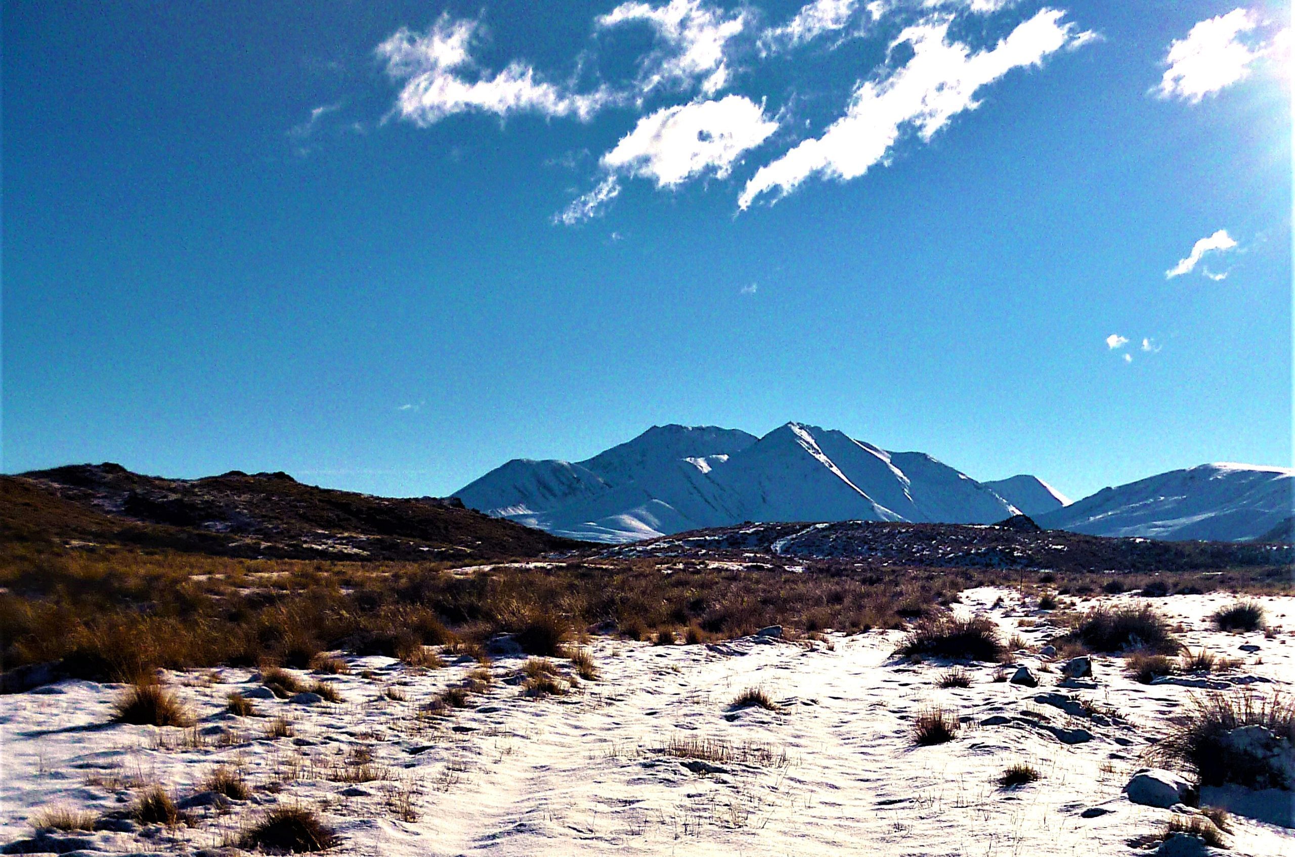
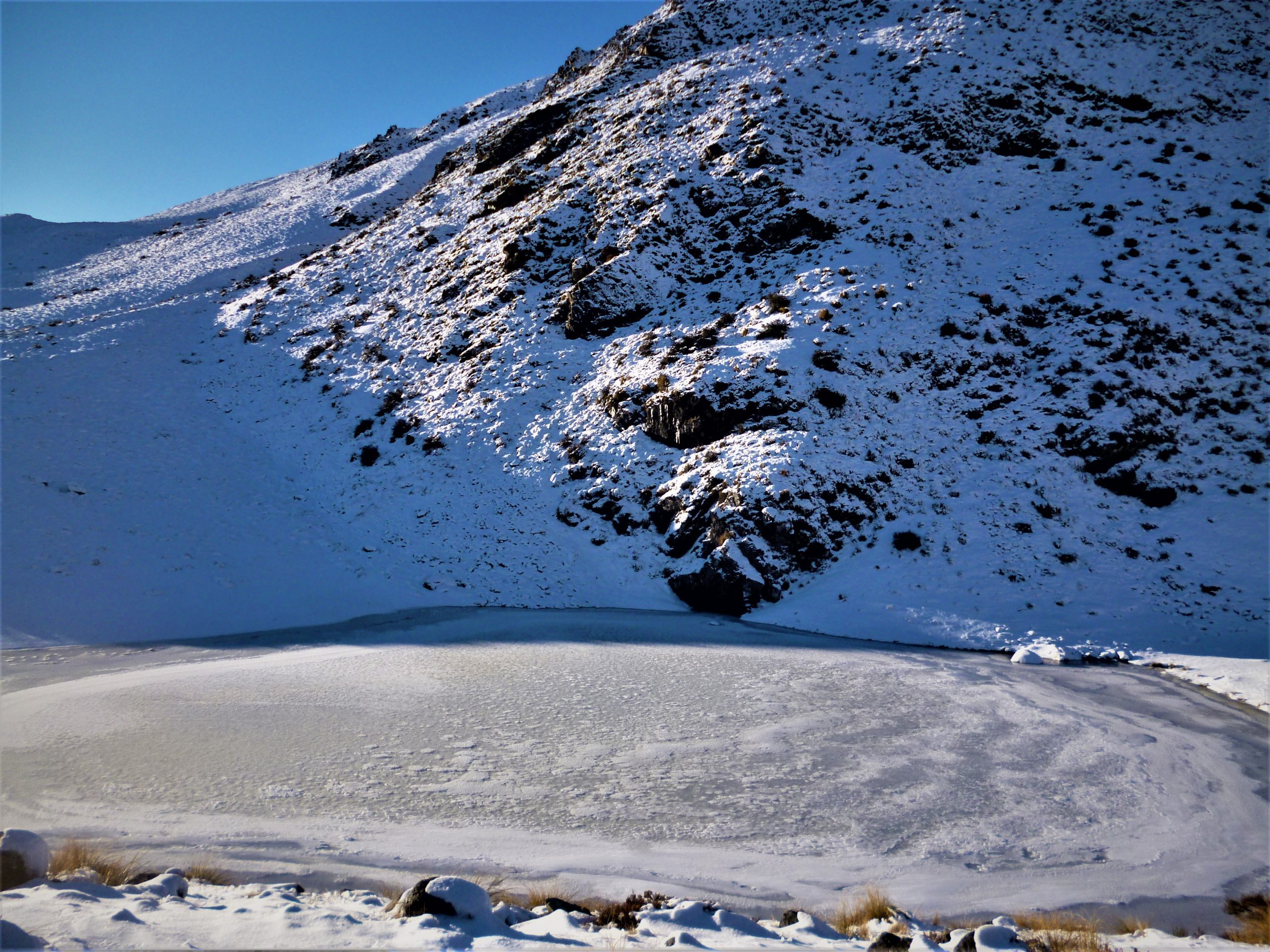
After travelling for several hours through increasingly deepening snow I eventually got to a frozen Mystery Lake(1091m), however at this stage the lake was just a mysterious body of water in a place I was lost in. Hindsight is a funny thing as thanks to not having a map of this area I missed another opportunity to get to Boundary Creek Hut. I was only a stone’s throw away from the hut at this stage and if I had turned right just before the lake, I would have ended up at the place I wanted to get to.
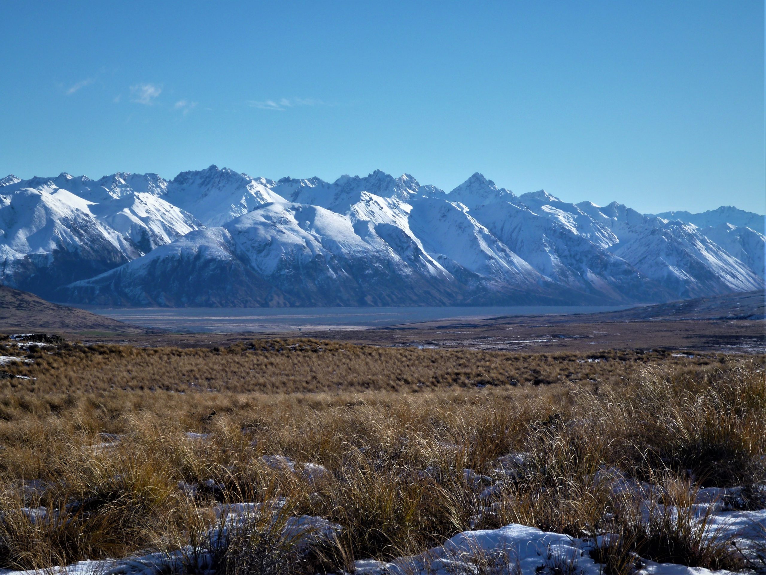
I made my way past the impressive spectacle of a completely frozen Mystery Lake (the name was perfect for my situation!) and its icy surroundings before starting to descend towards the Rangitata River and the big peaks of the Two Thumb Range just beyond the huge expanse of the riverbed.
The sun had disappeared behind Mt D'Archiac(2875m) and its lofty mountain mates and evening had arrived at Hakatere. With the darkness of night closely pursuing the dim light of sunset, I made the decision to stop and assess my hut-less situation. I needed shelter and I needed to find it ASAP. Due to the extremely low temperatures over the previous couple of days, some of the matagouri bushes in the area had small, sheltered caves under them caused by the snow freezing on top. I didn't have a bivvy bag (I purchased one not long after this trip/experience!) or sleeping mat as I had planned to spend a night in a hut with comfy bunks…