Boundary Creek Hut / Dogs Hill(1169m) · Hakatere Conservation Area
Hiking to a hut is a passtime enjoyed by many people around the world. Sometimes I almost feel guilty about how many huts are on offer in New Zealand’s backcountry. On this mish I was back after an adventure that didn’t go as planned and involved a night under a bush. What some would consider a failure I saw as a lesson in map reading and a chance to test what I would do if I didn’t find the shelter I planned on getting to…
The rain had soaked the track to Boundary Creek Hut in places, and this, along with the creek crossings, left me with the familiar feeling of damp socks in wet boots.
I arrived at the point where I had taken a wrong turn fourteen months earlier and within that amount of time there had been signs installed. I’m guessing I might not have been the only person to get a little bit lost amongst the maze of old farm tracks. Now that I was definitely on the right trail to the hut my mind was at ease and I could take in the environment I was hiking in.
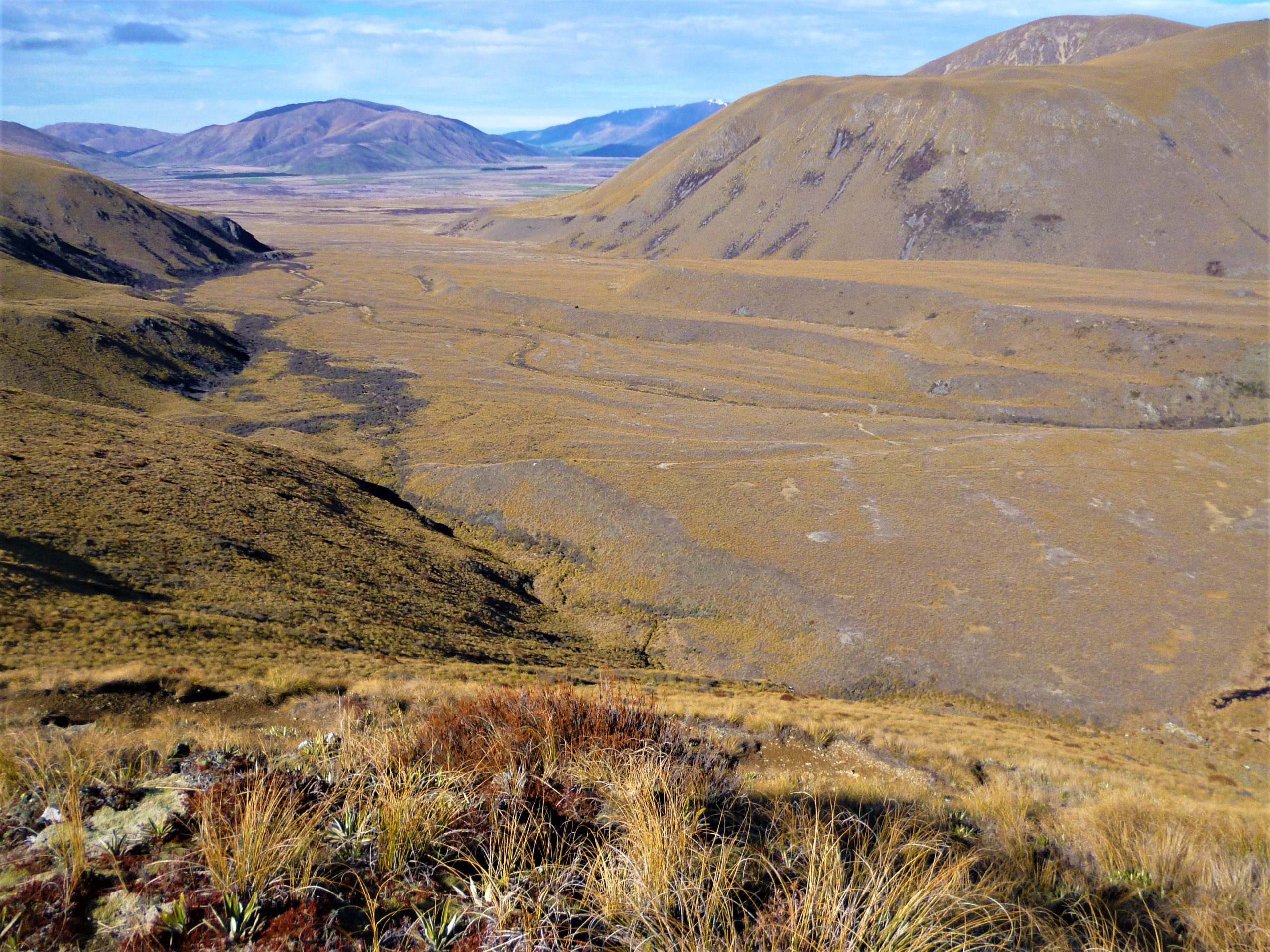
With clouds clearing and more and more blue sky appearing I was in my happy place as I made my way over the small saddle and looked up the South Branch of the massive Hakatere / Ashburton Valley. I would return a couple of years later to explore the upper reaches of the valley and stay at Top Hut, but for now my focus was on Boundary Creek and the hut built there.
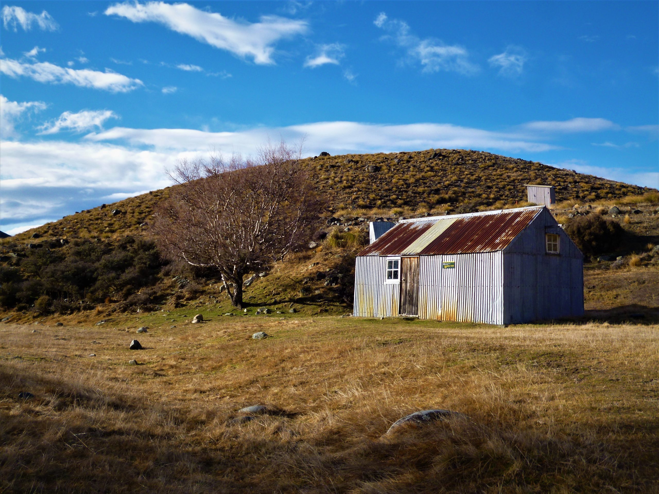
I spotted the hut’s toilet first, then finally saw the historic musterers hideaway, Boundary Hut, only fourteen months behind schedule. It was awesome to open the door and peer into the hut for the first time. The hut’s interior had everything you need when seeking shelter in the wild. I could see that, to go with the hut’s eight bunks, there was also a comfy couch (RIP) which I could stretch out on beside the open fire as I happily began to dry out my wet feet, socks and boots.
After a very enjoyable night an early-ish start the next day had me on the move at first light. I had some ground to cover and I wanted to get started as soon as I could. My plan was to return to the Paddle Hill Creek car park via a climb over Dog Hills north west peak(1169m).
After cleaning up I shut the hut’s door and was thankful for firstly finding it, and secondly the excellent night I had had. Next was retracing my steps up towards the saddle where I had got my first view of the upper Hakatere / Ashburton River. It was here where I began my off track challenge.
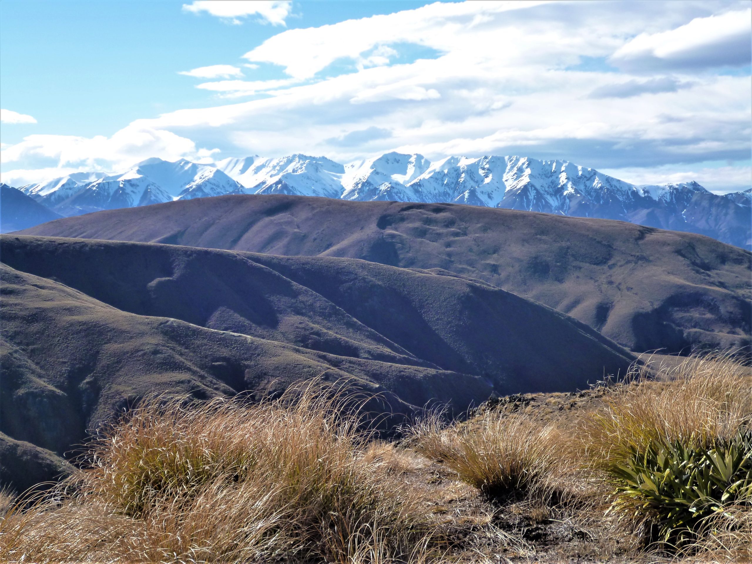
The climb was more uphill hiking than scrambling, and this gave me a chance to look around at the views. I had a 360 degree view from the top of the mountains of Hakatere and had to have a morning tea break so I could soak in the awesomeness.
After Dogs Hill I dropped back down towards Paddle Hill Stream and my car. I had managed to keep my boots dry up until this point and due to the fact that I could see my car, I didn’t mind the polar plunge I needed to get back to the right side of the stream.
With the car only a couple of steps away I could begin to celebrate victory over getting lost and also rest my well used feet. On my drive home I thought about getting lost and how foolish I was back then, and also how much I had learned during the fourteen months away. I am positive that I will never walk off the map in the future!