Mt Titiroa(1715m) · Fiordland National Park
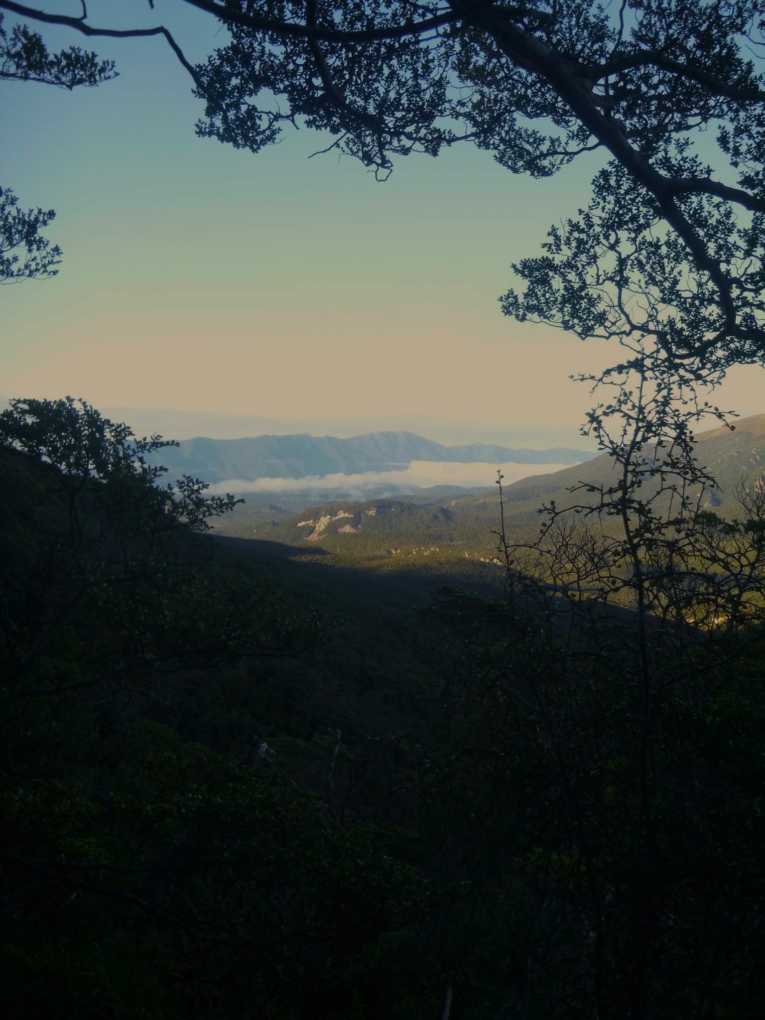
Not long after cresting the top of Gorge Hill and entering the farmlands east of Te Anau, a beautiful and always white-capped peak can be seen on a clear day. The white granite sands of Mt Titiroa(1715m) really make the peak stand out from the other impressive mountains that stand around it. The mountain sits like a guardian on the eastern reaches of Fiordland National Park, watching all who enter...
The normal route most take to climb Mt Titiroa(1715m) is from Hope Arm on Lake Manapouri. The climb begins from behind the hut via the Garnock Burn Valley, and while ascending you get outstanding views of Lake Manapouri. Of course, to get to the start of this route you need a boat. To avoid a trip across Lake Manapouri there is an alternative route to the summit, and this was the way my girlfriend and I were going to go to tackle Mt Titiroa(1715m).
Plan B for those wanting to climb the peak without a boat trip is via the North Borland Burn Valley. To get there you need to head south from Te Anau to the start of the Borland Road near Blackmount.
Being a trip in Fiordland National Park meant it began like so many other adventures, with the smells and sounds of the pitter-patter of rain. However, the forecast had promised a break in the weather for the following couple of days, so we hoped the forecasters hadn’t got it wrong as we were excited to finally have a crack at Lake Manapouri’s famous mountain.
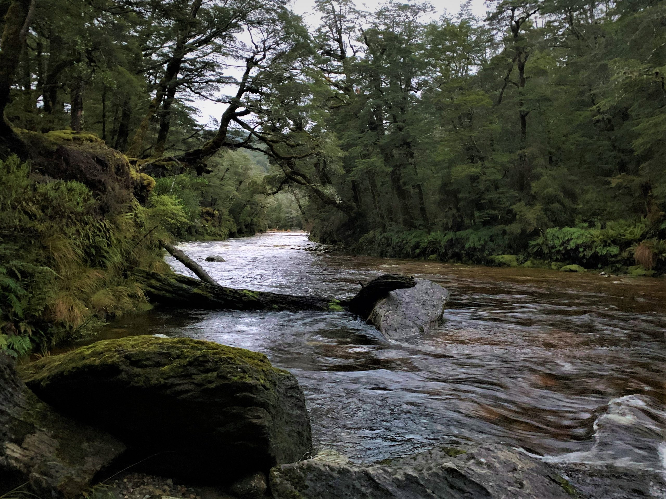
After passing Borland Lodge and heading up the road for about ten minutes we got to the start of the track. We locked up the car and the real mish began. We hiked alongside some really cool cliffs which are worth a visit in their own right. After the cliffs we dropped down a couple hundred metres in altitude to join the track that crosses the South Branch of the Borland Burn and then continues up the North Borland Burn.
There is no bridge over the Middle Branch of the Borland Burn so it was time to get wet feet. Sometimes the short distance across a river can seem like the longest part of the entire journey. After the refreshing river crossing, the track climbed its way into the remote valley of the North Branch of the Borland Burn. This mountainous country is usually only seen by the keenest Hunter Mountain hunters or adventurers, and we felt like a special select few as we pushed on further.
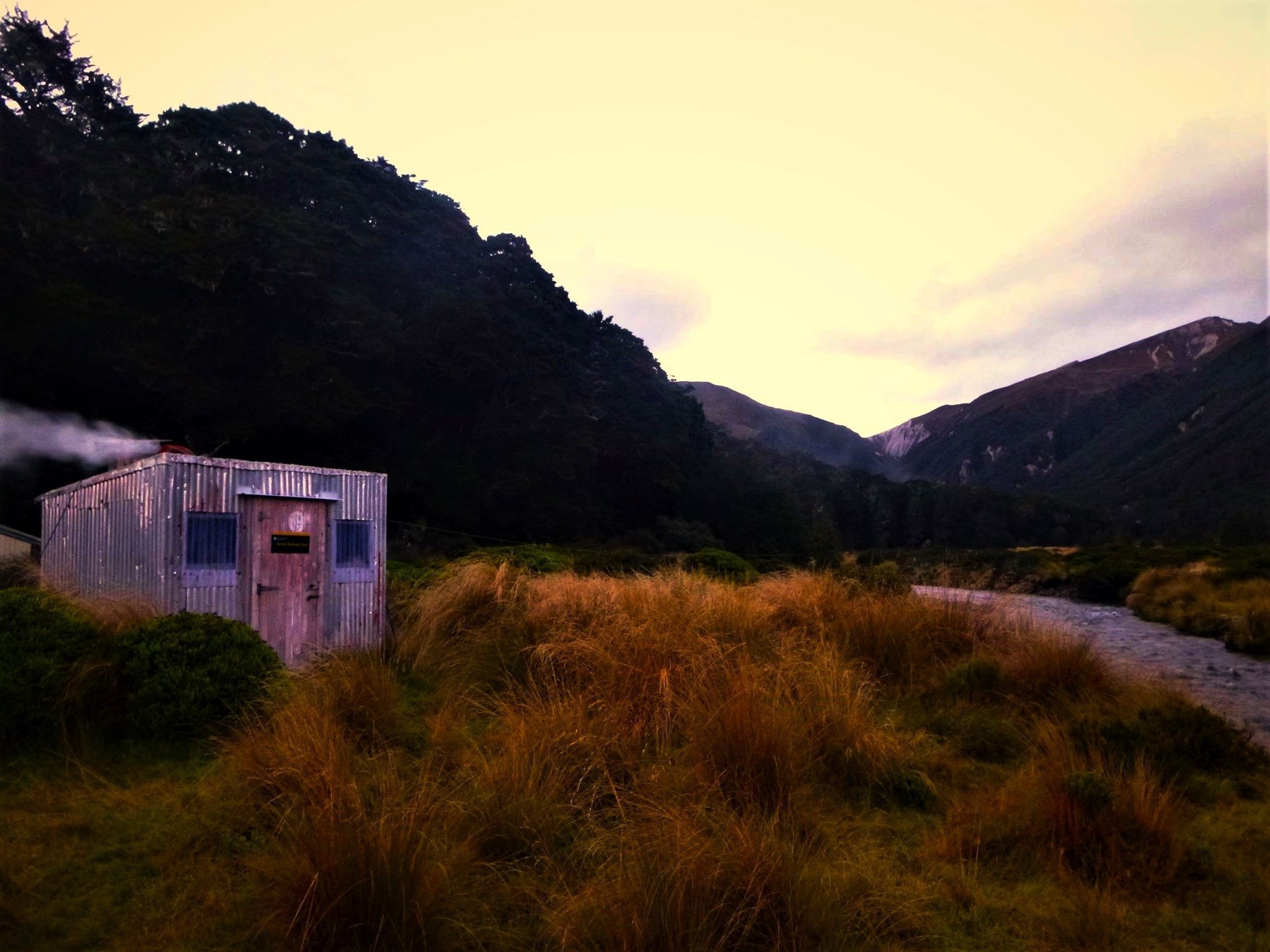
About two thirds of the way up the valley is the North Borland Bivouac. The 2-bunk hut is a relic of the deer-culler days of the past, and now serves as a tiny shelter in a stunning location. The hut is small enough that if you stand in the middle, you can touch both sides. The hut’s size was no issue for us as small is easier to warm. We had completed day one of our mish and now it was time to talk Titiroa and refuel with a good mountain meal.
After a good night’s rest in the cosy hut (a little bit smokey) an early-ish start was needed so we could make the most of the daylight. Our goal was to get up and down the mountain in one push, and this meant we had some ground to cover. It was time to put our feet on the white sands in the sky above Lake Manapouri…