Hakatere Conservation Area
Mt Taylor(2333m), and the rest of the Taylor Range are the largest mountains east of Ka Tiritiri o Te Moana/Southern Alps until you reach the giants of the Kaikoura Mountains further north. And, although large, most of the peaks are more like steep hikes than mountaineering / climbing...
On an early winter's day in June with no ski-able snow on the hills, I decided to head into Hakatere with long time mission buddy Celine, to have a look at the Taylor Range, and possibly climb one of the bigger peaks. We drove to the small car park at the south end of Lake Heron, and eagerly got our gear out of the car, excited about heading into the hills. Both of us would much rather spend a night in a tent over a hut, so we walked past Double Hut on our way to a campsite up the South Branch of the Swin River. From our elevated campsite we could see the glimmer of the moon shining on the dark waters of Lake Heron, and a billion and one stars covering the sky during the perfect still Hakatere night.
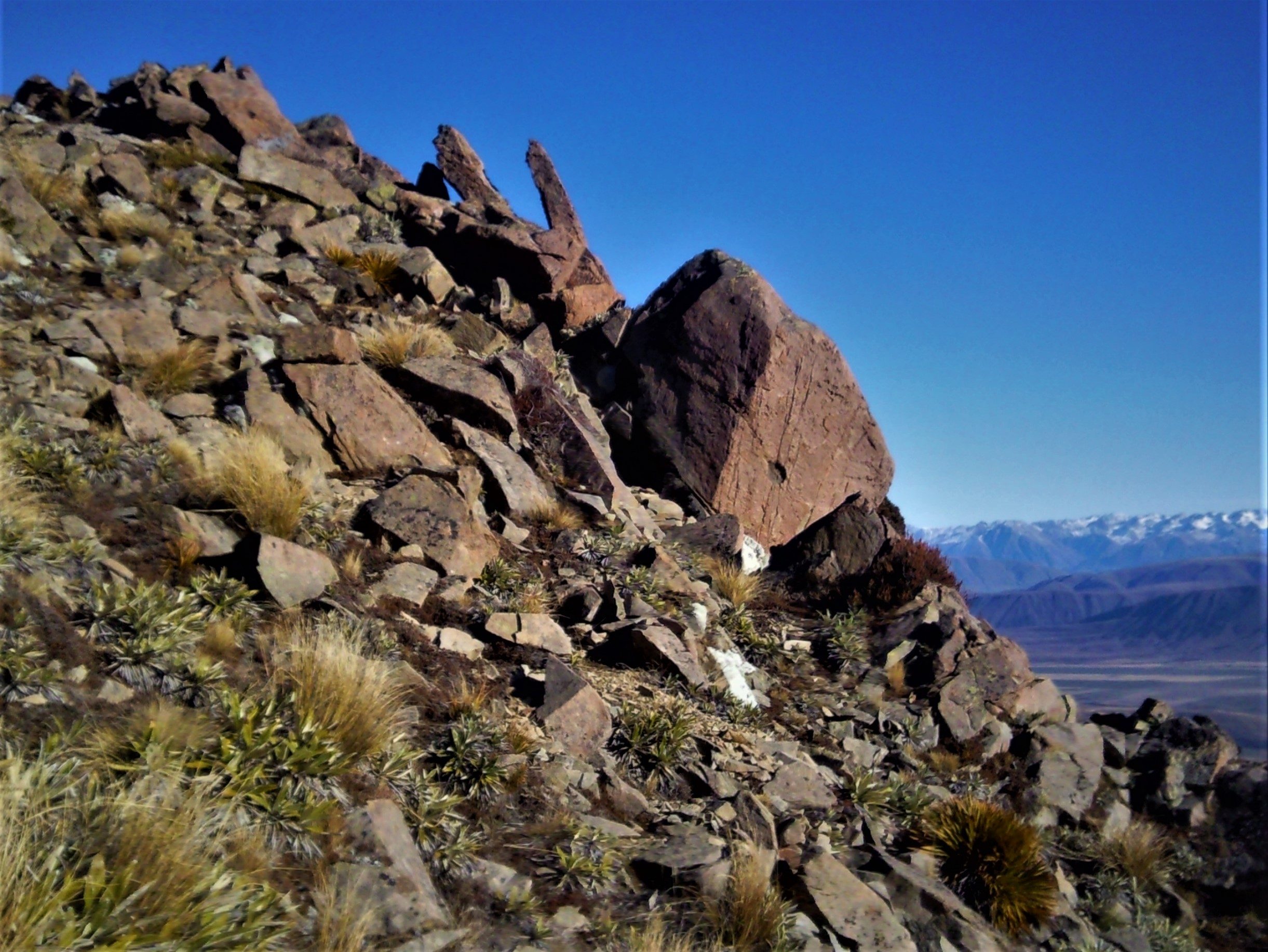
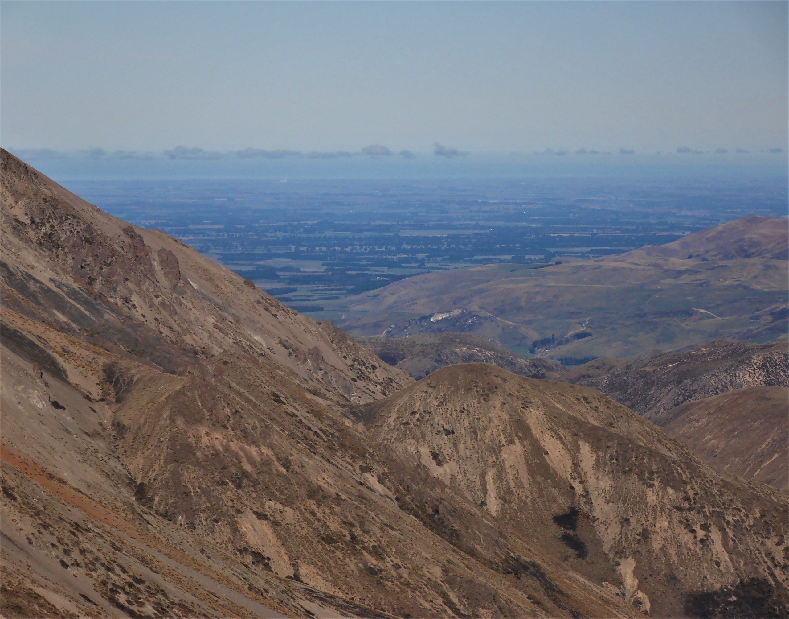
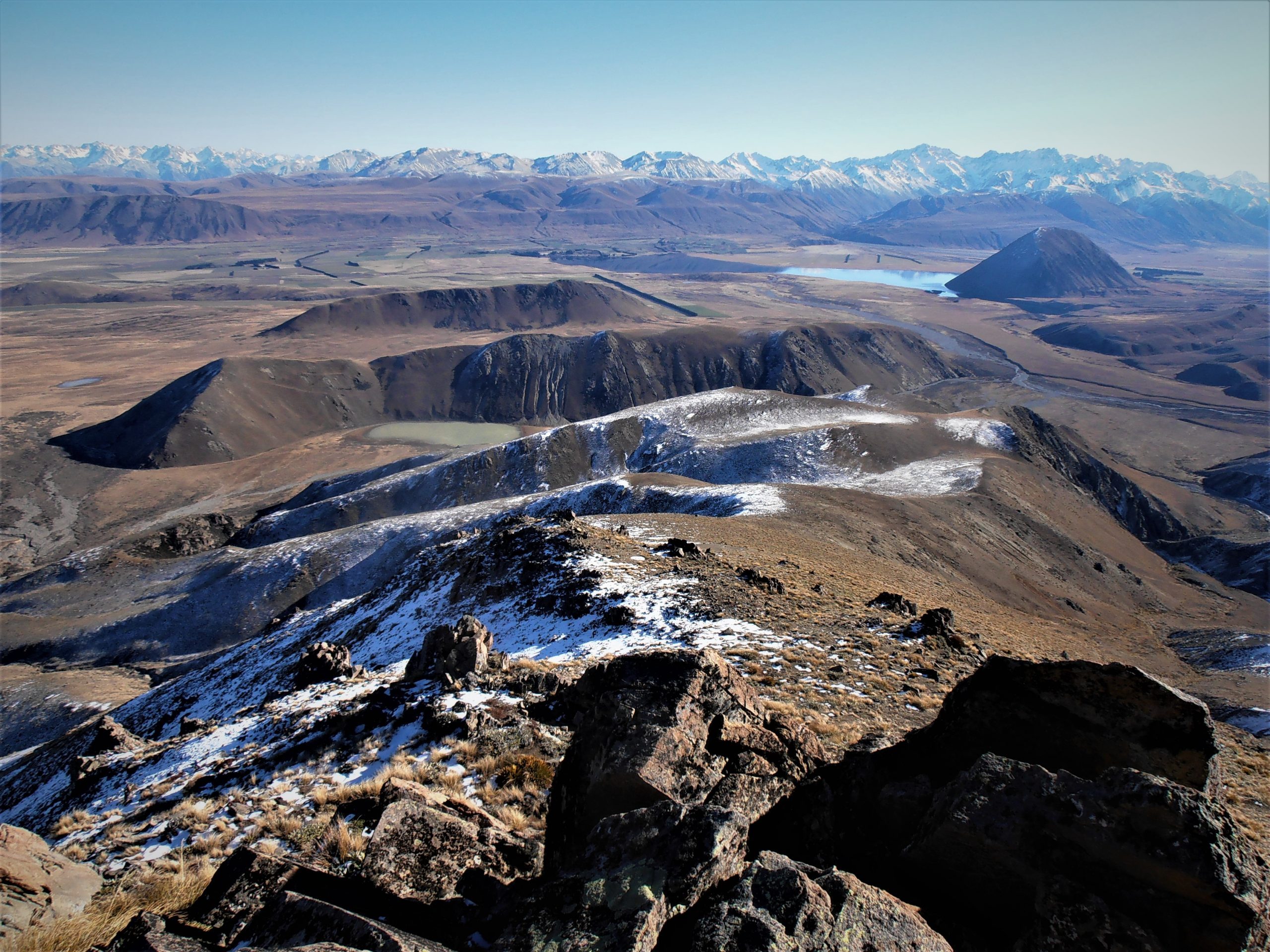
An early-ish start the next day had us on the move before first light, and the scramble up to the main ridge was a great way to get the blood flowing on a chilly morning in the mountains. Our aim was one of ‘The Fingers’, a series of peaks south west of Mt Taylor(2333m). To get there we followed the ridge directly above our camp all the way to the top of Peak 2016m (one of 'The Fingers' peaks). On our journey up the ridge we encountered multiple outcrops of deep red rock, which looked very interesting sticking up out of the bright white snow higher on the mountain. The summit views were epic, and not only did we have a bird’s eye view over the huge Lake Heron Basin area, we could also see over the lower peaks in the east to the fields of the Canterbury Plains. Leaving the summit was easier said than done, and continuing further on to Mt Taylor(2333m) was considered, but sadly time was against us, and we started heading down as we needed to get back to town that evening. Our hike down the mountain was complemented with stunning views of Mt Arrowsmith(2781m), and its snow covered, glacial carved neighbors. The grind along the long ridge meant it was well into the afternoon by the time we got back to our campsite, and we knew we would be pushing it to get back to the car before nightfall. In fading light we made our way along the track towards Lake Heron, and as some icing on the mission cake, we had another perfect clear evening for our moonlit twilight wander back to the car. As per usual, Hakatere didn’t disappoint, and we were both a little tired from our adventure. Still pumped from our climb, on the drive back to Christchurch we were already talking about our next mountain mish…